
Cycling in Chelsea
Discover a map of 109 cycling routes and bike trails near Chelsea, created by our community.
Region portrait
Get to know Chelsea
Find the right bike route for you through Chelsea, where we've got 109 cycle routes to explore. Most people get on their bikes to ride here in the months of July and August.
2,523 km
Tracked distance
109
Cycle routes
35,177
Population


From our community
The best bike routes in and around Chelsea

Bike Week Day 4: East Boston Greenway
Cycling route in Chelsea, Massachusetts, United States
- 7.3 km
- Distance
- 24 m
- Ascent
- 23 m
- Descent


airport sta - deer island
Cycling route in Chelsea, Massachusetts, United States
- 11.5 km
- Distance
- 569 m
- Ascent
- 569 m
- Descent


Border Street 126, Boston to Long Wharf 66, Boston
Cycling route in Chelsea, Massachusetts, United States
- 30.2 km
- Distance
- 120 m
- Ascent
- 88 m
- Descent
Discover more routes
 US1 Boston - Ellisville
- Distance
- 96.6 km
- Ascent
- 314 m
- Descent
- 314 m
- Location
- Chelsea, Massachusetts, United States
 Cinq Coins 1 19 Sa
- Distance
- 116.2 km
- Ascent
- 882 m
- Descent
- 865 m
- Location
- Chelsea, Massachusetts, United States
 7/26 Boston to Brookfield MA
- Distance
- 117.8 km
- Ascent
- 1,312 m
- Descent
- 1,088 m
- Location
- Chelsea, Massachusetts, United States
 Recovered Route
- Distance
- 38.9 km
- Ascent
- 0 m
- Descent
- 6 m
- Location
- Chelsea, Massachusetts, United States
 Washington Avenue 422, Chelsea to Hall Street 174, Dunstable
- Distance
- 55.9 km
- Ascent
- 712 m
- Descent
- 666 m
- Location
- Chelsea, Massachusetts, United States
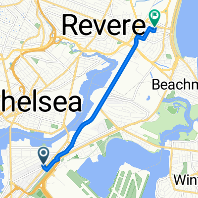
 Transportation Way, Boston to 10 Ocean Ave, Revere
- Distance
- 7.8 km
- Ascent
- 26 m
- Descent
- 28 m
- Location
- Chelsea, Massachusetts, United States
 75 Addison St, Chelsea to Northern Strand Community Trail, Everett
- Distance
- 3.4 km
- Ascent
- 15 m
- Descent
- 16 m
- Location
- Chelsea, Massachusetts, United States
 kayla’s house vibes 👻⭐️
- Distance
- 4.8 km
- Ascent
- 42 m
- Descent
- 34 m
- Location
- Chelsea, Massachusetts, United States