
Cycling in Sugarcreek
Discover a map of 4 cycling routes and bike trails near Sugarcreek, created by our community.
Be a pioneer
Inspire fellow cyclists with your route in Sugarcreek
Bikemap is a global cycling community with millions of routes created by cyclists like you. There are only a few routes so far in Sugarcreek, so plot your favourite rides on the map now to help others find the best ways to ride.
From our community
The best bike routes in and around Sugarcreek

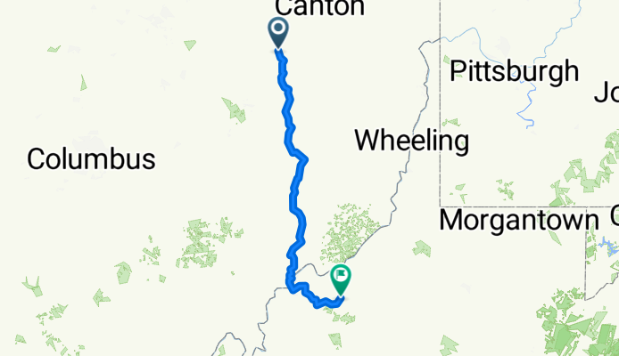
At Holmes with the Amish
Cycling route in Sugarcreek, Ohio, United States
- 46 km
- Distance
- 327 m
- Ascent
- 327 m
- Descent
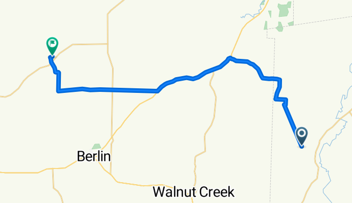
Hardy Drive Northwest to County Road
Cycling route in Sugarcreek, Ohio, United States
- 23 km
- Distance
- 246 m
- Ascent
- 215 m
- Descent
Township Road to Goose Creek Road
Cycling route in Sugarcreek, Ohio, United States
- 243.2 km
- Distance
- 4,504 m
- Ascent
- 4,569 m
- Descent
