
Cycling in Bellingham
Discover a map of 401 cycling routes and bike trails near Bellingham, created by our community.
Region portrait
Get to know Bellingham
Find the right bike route for you through Bellingham, where we've got 401 cycle routes to explore. Most people get on their bikes to ride here in the months of August and September.
23,903 km
Tracked distance
401
Cycle routes
80,885
Population
Community
Most active users in Bellingham


Handpicked routes
Discover Bellingham through these collections
Tour
From our community
The best bike routes in and around Bellingham
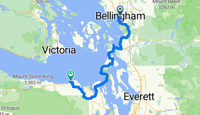
Kearney St, Bellingham to Voice of America Rd, Sequim
Cycling route in Bellingham, Washington, United States
- 212.8 km
- Distance
- 2,840 m
- Ascent
- 2,829 m
- Descent


Bellingham to Snohomish: scenic route
Cycling route in Bellingham, Washington, United States
- 132.5 km
- Distance
- 994 m
- Ascent
- 952 m
- Descent

10 mile loop
Cycling route in Bellingham, Washington, United States
- 16.2 km
- Distance
- 156 m
- Ascent
- 158 m
- Descent

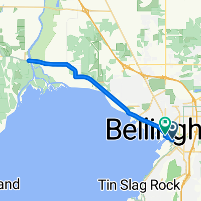
Back roads Birchwood to Birch Bay State Park
Cycling route in Bellingham, Washington, United States
- 31.8 km
- Distance
- 205 m
- Ascent
- 221 m
- Descent
Discover more routes
 BellinghamTrails-CornwallPark-Waterfront-Chuckanut-Interurban-PipelineTrail-Bloedel-RailroadTrail
- Distance
- 52.1 km
- Ascent
- 353 m
- Descent
- 351 m
- Location
- Bellingham, Washington, United States
 S. Pass/ Mosquito Route
- Distance
- 123.1 km
- Ascent
- 727 m
- Descent
- 729 m
- Location
- Bellingham, Washington, United States
 after work loop
- Distance
- 19.1 km
- Ascent
- 195 m
- Descent
- 197 m
- Location
- Bellingham, Washington, United States
 Bellingham-Ferndale-RedRiver-MariettaLoop
- Distance
- 49.6 km
- Ascent
- 149 m
- Descent
- 149 m
- Location
- Bellingham, Washington, United States
 to fairhaven
- Distance
- 11 km
- Ascent
- 59 m
- Descent
- 85 m
- Location
- Bellingham, Washington, United States
 3 hr Chuckanut
- Distance
- 60.9 km
- Ascent
- 579 m
- Descent
- 579 m
- Location
- Bellingham, Washington, United States
 fairhaven to birch bay
- Distance
- 36.3 km
- Ascent
- 157 m
- Descent
- 168 m
- Location
- Bellingham, Washington, United States
 Commercial Street to C Street
- Distance
- 20.3 km
- Ascent
- 100 m
- Descent
- 111 m
- Location
- Bellingham, Washington, United States