
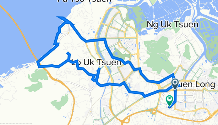
元朗公園..雞伯嶺..流浮山..元朗
A cycling route starting in Yuen Long Kau Hui, Yuen Long District, Hong Kong.
Overview
About this route
0
- 6:05 h
- Duration
- 20.3 km
- Distance
- 256 m
- Ascent
- 244 m
- Descent
- 3.3 km/h
- Avg. speed
- 41 m
- Max. altitude
Troublesaver Karl
created this 4 years ago
Route photos


Continue with Bikemap
Use, edit, or download this cycling route
You would like to ride 元朗公園..雞伯嶺..流浮山..元朗 or customize it for your own trip? Here is what you can do with this Bikemap route:
Free features
- Save this route as favorite or in collections
- Copy & plan your own version of this route
- Sync your route with Garmin or Wahoo
Premium features
Free trial for 3 days, or one-time payment. More about Bikemap Premium.
- Navigate this route on iOS & Android
- Export a GPX / KML file of this route
- Create your custom printout (try it for free)
- Download this route for offline navigation
Discover more Premium features.
Get Bikemap PremiumFrom our community
Other popular routes starting in Yuen Long Kau Hui
- Castle Peak Rd-Yuen Long, Kam Tin, Yuen Long to Tung Wui Rd, Kam Tin, Yuen Long0
- 4.3 km
- 10 m
- 13 m
- Yuen Long Kau Hui, Yuen Long District, Hong Kong
- Maclehose Trail Sec 10, Tai Lam to Maclehose Trail Sec 10, Tai Lam0
- 12.1 km
- 527 m
- 526 m
- Yuen Long Kau Hui, Yuen Long District, Hong Kong
- Castle Peak Rd-Tam Mi, Tam Mei, Yuen Long to Sam Wo Rd, Shuen Wan, Tai Po0
- 41.2 km
- 377 m
- 374 m
- Yuen Long Kau Hui, Yuen Long District, Hong Kong


Open it in the app