

Cantal 2022 N° 4 - 117km 2500D+
A cycling route starting in Riom-ès-Montagnes, Auvergne-Rhône-Alpes, France.
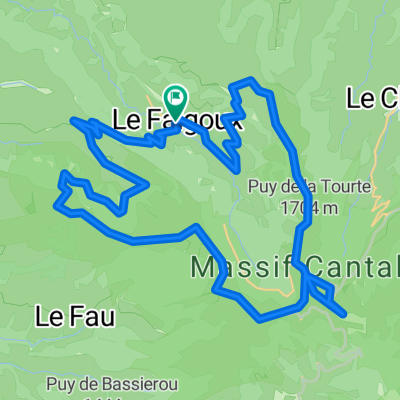
Overview
About this route
117km --Puy Marie-le Claux- Cheylade - Pierrebesse - Riom les Montagnes - St Amandin - Gorges de la Rue - dir Champs Tarentaine - Embort - Lastiolle(barrage) - Trémouille - St Amandin - Rioms les Montagnes - Valettes - Marcombes - Le Falgoux
- -:--
- Duration
- 116.5 km
- Distance
- 2,734 m
- Ascent
- 2,734 m
- Descent
- ---
- Avg. speed
- 1,581 m
- Max. altitude

Route quality
Waytypes & surfaces along the route
Waytypes
Road
24.5 km
(21 %)
Quiet road
7 km
(6 %)
Surfaces
Paved
53.6 km
(46 %)
Unpaved
3.5 km
(3 %)
Asphalt
53.6 km
(46 %)
Unpaved (undefined)
3.5 km
(3 %)
Undefined
59.4 km
(51 %)
Continue with Bikemap
Use, edit, or download this cycling route
You would like to ride Cantal 2022 N° 4 - 117km 2500D+ or customize it for your own trip? Here is what you can do with this Bikemap route:
Free features
- Save this route as favorite or in collections
- Copy & plan your own version of this route
- Split it into stages to create a multi-day tour
- Sync your route with Garmin or Wahoo
Premium features
Free trial for 3 days, or one-time payment. More about Bikemap Premium.
- Navigate this route on iOS & Android
- Export a GPX / KML file of this route
- Create your custom printout (try it for free)
- Download this route for offline navigation
Discover more Premium features.
Get Bikemap PremiumFrom our community
Other popular routes starting in Riom-ès-Montagnes
 Trip vélo Cantal - Corrèze 2011
- Distance
- 299.2 km
- Ascent
- 2,021 m
- Descent
- 2,021 m
- Location
- Riom-ès-Montagnes, Auvergne-Rhône-Alpes, France
 Cantal 2022 N° 2 bis 103km 2110 D+
- Distance
- 103 km
- Ascent
- 2,461 m
- Descent
- 2,469 m
- Location
- Riom-ès-Montagnes, Auvergne-Rhône-Alpes, France
 Cantal2022 N°3 104km 2400 D+
- Distance
- 103.6 km
- Ascent
- 2,418 m
- Descent
- 2,416 m
- Location
- Riom-ès-Montagnes, Auvergne-Rhône-Alpes, France
 Cantal 2022 N° 4 - 117km 2500D+
- Distance
- 116.5 km
- Ascent
- 2,734 m
- Descent
- 2,734 m
- Location
- Riom-ès-Montagnes, Auvergne-Rhône-Alpes, France
 Cantal 2022 circuit N°1 - 43km samedi aprem
- Distance
- 43.2 km
- Ascent
- 951 m
- Descent
- 954 m
- Location
- Riom-ès-Montagnes, Auvergne-Rhône-Alpes, France
 Cantal 2022 N°1 bis 61km
- Distance
- 60.9 km
- Ascent
- 1,396 m
- Descent
- 1,397 m
- Location
- Riom-ès-Montagnes, Auvergne-Rhône-Alpes, France
 Le Puy Mary (1783m) et la vallée du Falgoux par les crêtes
- Distance
- 43.9 km
- Ascent
- 1,933 m
- Descent
- 1,934 m
- Location
- Riom-ès-Montagnes, Auvergne-Rhône-Alpes, France
 4.etapa Riom-es-Montagnes - Saint-Cirgues-De-Jordanne
- Distance
- 84.3 km
- Ascent
- 1,474 m
- Descent
- 1,454 m
- Location
- Riom-ès-Montagnes, Auvergne-Rhône-Alpes, France
Open it in the app