

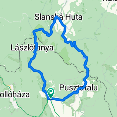
Touring 2.65 Kőkapu (RÖNK) - Szuha völgy - Pálháza
A cycling route starting in Gönc, Borsod-Abauj Zemplen county, Hungary.
Overview
About this route
- -:--
- Duration
- 13.6 km
- Distance
- 86 m
- Ascent
- 189 m
- Descent
- ---
- Avg. speed
- 263 m
- Max. altitude

Route quality
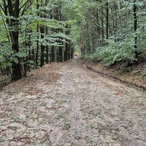
Waytypes & surfaces along the route
Waytypes
Quiet road
8.1 km
(59 %)
Busy road
2 km
(15 %)
Surfaces
Paved
11.7 km
(86 %)
Unpaved
1.2 km
(9 %)
Asphalt
10.7 km
(79 %)
Gravel
1 km
(7 %)
Continue with Bikemap
Use, edit, or download this cycling route
You would like to ride Touring 2.65 Kőkapu (RÖNK) - Szuha völgy - Pálháza or customize it for your own trip? Here is what you can do with this Bikemap route:
Free features
- Save this route as favorite or in collections
- Copy & plan your own version of this route
- Sync your route with Garmin or Wahoo
Premium features
Free trial for 3 days, or one-time payment. More about Bikemap Premium.
- Navigate this route on iOS & Android
- Export a GPX / KML file of this route
- Create your custom printout (try it for free)
- Download this route for offline navigation
Discover more Premium features.
Get Bikemap PremiumFrom our community
Other popular routes starting in Gönc
 Telkibánya, Sólyom-kő, Amadé-vár rom, Hejcei emlékpark kör
- Distance
- 31.4 km
- Ascent
- 864 m
- Descent
- 865 m
- Location
- Gönc, Borsod-Abauj Zemplen county, Hungary
 Kőkapu 2
- Distance
- 13 km
- Ascent
- 434 m
- Descent
- 433 m
- Location
- Gönc, Borsod-Abauj Zemplen county, Hungary
 Füzér, Izra-tó, Szalánchuta, Lászlótanya kör
- Distance
- 22.5 km
- Ascent
- 636 m
- Descent
- 636 m
- Location
- Gönc, Borsod-Abauj Zemplen county, Hungary
 Pálháza 30km körút
- Distance
- 14.2 km
- Ascent
- 80 m
- Descent
- 388 m
- Location
- Gönc, Borsod-Abauj Zemplen county, Hungary
 Telkibánya 38 km-es kör
- Distance
- 37.8 km
- Ascent
- 559 m
- Descent
- 559 m
- Location
- Gönc, Borsod-Abauj Zemplen county, Hungary
 Kő-kapu Kerek-kő- István-kút Kőkapu
- Distance
- 23.9 km
- Ascent
- 434 m
- Descent
- 432 m
- Location
- Gönc, Borsod-Abauj Zemplen county, Hungary
 Füzér-Nagy Milic - Füzér kör
- Distance
- 15.3 km
- Ascent
- 587 m
- Descent
- 596 m
- Location
- Gönc, Borsod-Abauj Zemplen county, Hungary
 Zemplén 2014.
- Distance
- 70.8 km
- Ascent
- 1,338 m
- Descent
- 1,338 m
- Location
- Gönc, Borsod-Abauj Zemplen county, Hungary
Open it in the app