

Overview
About this route
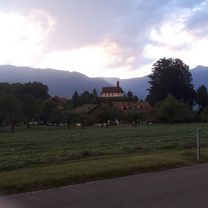
First stage of the KLB cycling pilgrimage from Eichstätt to Wertingen
- -:--
- Duration
- 69.9 km
- Distance
- 404 m
- Ascent
- 365 m
- Descent
- ---
- Avg. speed
- 519 m
- Max. altitude

Part of
Radwallfahrt 2022
7 stages
Route quality
Waytypes & surfaces along the route
Waytypes
Path
25.9 km
(37 %)
Quiet road
18.9 km
(27 %)
Surfaces
Paved
49.6 km
(71 %)
Unpaved
14.7 km
(21 %)
Asphalt
49.6 km
(71 %)
Gravel
14.7 km
(21 %)
Undefined
5.6 km
(8 %)
Continue with Bikemap
Use, edit, or download this cycling route
You would like to ride RWF 2022 1. Tag or customize it for your own trip? Here is what you can do with this Bikemap route:
Free features
- Save this route as favorite or in collections
- Copy & plan your own version of this route
- Sync your route with Garmin or Wahoo
Premium features
Free trial for 3 days, or one-time payment. More about Bikemap Premium.
- Navigate this route on iOS & Android
- Export a GPX / KML file of this route
- Create your custom printout (try it for free)
- Download this route for offline navigation
Discover more Premium features.
Get Bikemap PremiumFrom our community
Other popular routes starting in Eichstätt
 Wasserzell-Dollnstein und zurück
- Distance
- 23.8 km
- Ascent
- 416 m
- Descent
- 337 m
- Location
- Eichstätt, Bavaria, Germany
 Dom zu Eichstätt über Ingolstadt bis Wallheim und zurück
- Distance
- 100.1 km
- Ascent
- 347 m
- Descent
- 347 m
- Location
- Eichstätt, Bavaria, Germany
 3. Dienstag: Eichstätt-Denkendorf
- Distance
- 34.1 km
- Ascent
- 278 m
- Descent
- 178 m
- Location
- Eichstätt, Bavaria, Germany
 RT 2016, 1. Etappe; Eichstätt - Pappenheim
- Distance
- 32.9 km
- Ascent
- 221 m
- Descent
- 258 m
- Location
- Eichstätt, Bavaria, Germany
 RadTour 6: Geotoptour
- Distance
- 80.7 km
- Ascent
- 556 m
- Descent
- 555 m
- Location
- Eichstätt, Bavaria, Germany
 12-05-16 Bayern: Eichstätt (Altmühltal-Radweg)-Beilngries-Dietfurt-Deising
- Distance
- 65.4 km
- Ascent
- 186 m
- Descent
- 236 m
- Location
- Eichstätt, Bavaria, Germany
 Dom zu Eichstätt bis Pfünz und zurück über Wellheim
- Distance
- 67.5 km
- Ascent
- 322 m
- Descent
- 323 m
- Location
- Eichstätt, Bavaria, Germany
 Altmühl-Radweg: Eichstätt - Beilngries
- Distance
- 45.1 km
- Ascent
- 330 m
- Descent
- 353 m
- Location
- Eichstätt, Bavaria, Germany
Open it in the app