

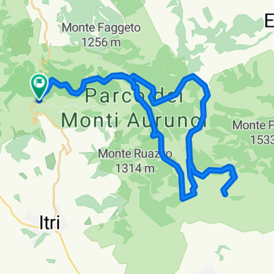
Campodimele Monte Faggeto
A cycling route starting in Campodimele, Lazio, Italy.
Overview
About this route
1
GUIDA AI PERCORSI IN MOUNTAINBIKE
nel Parco Naturale dei Monti Aurunci PERCORSO N.2
Breve percorso di andata e ritorno di circa 1h e 30', molto impegnativo a causa del notevole dislivello. Lo scenario che si può ammirare spazia dal Parco Nazionale d'Abruzzo Lazio e Molise alla piana di Fondi al Parco Nazionale del Circeo.
- -:--
- Duration
- 8.9 km
- Distance
- 830 m
- Ascent
- 243 m
- Descent
- ---
- Avg. speed
- ---
- Max. altitude
VisitAurunci
created this 17 years ago
Route highlights
Points of interest along the route
Point of interest after 0 km
Campodimele è la sede dell'Ente Regionale Parco dei Monti Aurunci che, con i suoi circa 20.000 ettari ne fa la seconda area protetta della Regione Lazio, gli uffici sono aperti tutti i giorni sabato e domenica escluso Tel.0771.598114 Fax 0771.598166 e-mail info@parcoaurunci.it
Point of interest after 8.8 km
Belvedere di Monte Faggeto, la sua apertura a 360° dalle isole Pontine al Parco d'Abruzzo Lazio e Molise, lo rende uno dei luoghi più suggestivi del Parco dei Monti Aurunci
Continue with Bikemap
Use, edit, or download this cycling route
You would like to ride Campodimele Monte Faggeto or customize it for your own trip? Here is what you can do with this Bikemap route:
Free features
- Save this route as favorite or in collections
- Copy & plan your own version of this route
- Sync your route with Garmin or Wahoo
Premium features
Free trial for 3 days, or one-time payment. More about Bikemap Premium.
- Navigate this route on iOS & Android
- Export a GPX / KML file of this route
- Create your custom printout (try it for free)
- Download this route for offline navigation
Discover more Premium features.
Get Bikemap PremiumFrom our community
Other popular routes starting in Campodimele
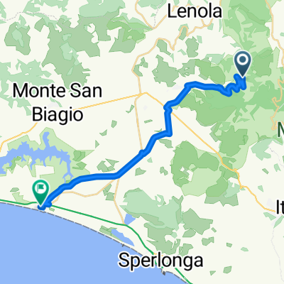
- Da Via Civita Farnese, Itri a Viale della Provincia 34–42, Itri0
- 8.6 km
- 24 m
- 325 m
- Campodimele, Lazio, Italy


Open it in the app