


2012-Thailand-Kambodscha
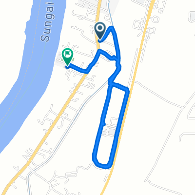
A cycling route starting in Kota Bharu, Kelantan, Malaysia.
Overview
About this route
0
- -:--
- Duration
- 1,908.7 km
- Distance
- 257 m
- Ascent
- 248 m
- Descent
- ---
- Avg. speed
- ---
- Max. altitude
euryoekie
created this 15 years ago
Route highlights
Points of interest along the route
Point of interest after 67 km
64 Km von Kota Bharu
Point of interest after 134.1 km
74 Km
Point of interest after 191.6 km
55 km
Point of interest after 304.2 km
103 km insgesamt 300km
Point of interest after 400.1 km
96 km insgesamt 391km
Point of interest after 472.8 km
73km insgesamt 464 km
Point of interest after 538.3 km
Point of interest after 593.3 km
geht eine Strasse am Meer/Gebirge nach Khanom?
Point of interest after 618.2 km
78 km insgesamt 607 km
Point of interest after 619.3 km
fähre nach ko samui weiter ko pha ngan oder ko tao
Point of interest after 620 km
Delphine am Nachmittag hinter dem Kraftwerk, Mangrovenwald, Khao-Wang-Thon-Höhlen
Point of interest after 698 km
82 km Surat Thani insgesamt 689km
Point of interest after 771.2 km
73 km insgesamt 762 km
Point of interest after 844.6 km
75 km insgesamt 837km
Point of interest after 941.7 km
97 km insgesamt 935
Point of interest after 990.3 km
schönster Strand Thailands 18 km (kohlekraftwerk) 50 km 985 km
Point of interest after 991 km
schönster und längster Strand Thailand, 50 km insgesamt 984km
Point of interest after 1,091.7 km
93 km 1081 km
Point of interest after 1,140.5 km
50 km 1130 gesamt
Point of interest after 1,230 km
90km 1220 gesamt
Point of interest after 1,315.1 km
80km 1300gesamt
Point of interest after 1,392.9 km
75km 1375gesamt schwimmende Märkte
Point of interest after 1,482.7 km
90km 1465gesamt
Point of interest after 1,574.5 km
90km 1600gesamt
Point of interest after 1,678.1 km
100km 1660gesamt
Point of interest after 1,773.6 km
90km 1750gesamt
Point of interest after 1,849.2 km
75km 1825gesamt Überfahrt nach Ko Chang
Point of interest after 1,908.7 km
80km 1905gesamt
Point of interest after 1,908.7 km
35km 1940gesamt Grenzübergang
Continue with Bikemap
Use, edit, or download this cycling route
You would like to ride 2012-Thailand-Kambodscha or customize it for your own trip? Here is what you can do with this Bikemap route:
Free features
- Save this route as favorite or in collections
- Copy & plan your own version of this route
- Split it into stages to create a multi-day tour
- Sync your route with Garmin or Wahoo
Premium features
Free trial for 3 days, or one-time payment. More about Bikemap Premium.
- Navigate this route on iOS & Android
- Export a GPX / KML file of this route
- Create your custom printout (try it for free)
- Download this route for offline navigation
Discover more Premium features.
Get Bikemap PremiumFrom our community
Other popular routes starting in Kota Bharu

 Jalan Sultan Yahya Petra 5375E to Jalan Sultan Yahya Petra 5375E0
- 19.5 km
- 63 m
- 65 m
- Kota Bharu, Kelantan, Malaysia
 Jalan Sri Sentosa Panji 2/51 338, Kota Bharu to Jalan Sri Sentosa Panji 2/51 338, Kota Bharu0
- 2.9 km
- 65 m
- 64 m
- Kota Bharu, Kelantan, Malaysia

 Jalan Sri Sentosa Panji 2/51 338, Kota Bharu to Jalan Sri Sentosa Panji 2/51 338, Kota Bharu0
- 1.6 km
- 38 m
- 24 m
- Kota Bharu, Kelantan, Malaysia


Open it in the app