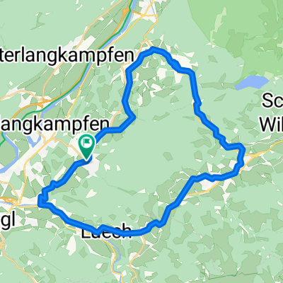
Rund um den Pölven
- 32 km
- 556 m
- 556 m
- Bad Häring, Tyrol, Austria
A cycling route starting in Bad Häring, Tyrol, Austria.
Overview
Trail Variant
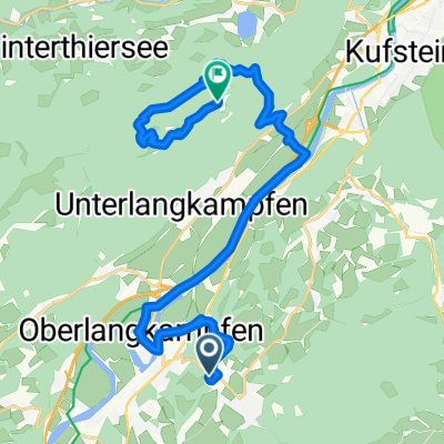
Track V3 leads to Horlerstiegl as well. However, on the descent, you turn off at the first curve towards Steinbaumgartlalm. There, you carry the bike for about 50 meters to the next forestry road. This forestry road leads to a short but steep S2 trail in the woods. Beware of moisture - roots are slippery! If you don't want to ride the trail, stay on the forestry road. Both paths meet again in Auffach. Return through Oberau and Zauberwinkel to Wörgl.A nice track that goes from Penningberg into the calves and, if you're riding briskly, brings the thighs to a glow. Because the Kitzbühel Alps are very beautiful in terms of terrain, this route also has its idyllic aspects. For hardcore enthusiasts, man-eaters, and large-lunged individuals, it's easy and a reasonable appetizer. For mountain bikers like me, however, it's a big challenge. In the summer, it's best to start as early as possible since the entire Penningberg is in the blazing sun. At the fork "Berghotel Panorama" on Flecklweg, there's a fountain where you can refill your water bottle.
created this 14 years ago
Continue with Bikemap
You would like to ride Häring - Stallhäusl - Markbachjochtour or customize it for your own trip? Here is what you can do with this Bikemap route:
Free trial for 3 days, or one-time payment. More about Bikemap Premium.
Discover more Premium features.
Get Bikemap PremiumFrom our community
Open it in the app