

Z HUMPOLCE K ŘECE SÁZAVA, LIPNICI NAD SÁZAVOU, HRADU ORLÍK A ZPĚT DO HUMPOLCE
A cycling route starting in Humpolec, Kraj Vysočina, Czechia.
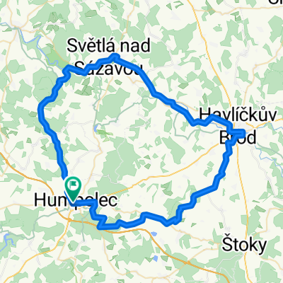
Overview
About this route
- -:--
- Duration
- 47.7 km
- Distance
- 739 m
- Ascent
- 739 m
- Descent
- ---
- Avg. speed
- ---
- Max. altitude

Route highlights
Points of interest along the route
Point of interest after 4.2 km
ZDE ZAČÍNÁ TRASA PO TURISTICKÉ ČERVÉNÉ ZNAČCE, KDY SE PO TÉTO DÁME NA MTB AŽ NA ROHULI ZA OBCÍ REJČKOV, POD VRCH MELECHOV
Point of interest after 7.4 km
VJEZD DO LESA KDY JE ZDE NĚKOLIK MOŽNÝCH TRAS JEŽ VEDOU DO OBCE KALIŠTĚ, PROSEČ..., OBZVLÁŠŤ NA PODZIM JE TO ZDE MIMO HLAVNÍ CESTY PARÁDA, PLNO BAREV, KDO FOTÍ SI UŽIJE :-)

Point of interest after 9.4 km
POZŮSTATEK STŘEDOVĚKÉ TVRZE U OBCE PROSEČ
Point of interest after 10.7 km
ZDE BYLA U TOHOTO RYBNÍKA NALEZENA NĚJAKÁ PREHISTORICKÁ KVĚTINA ČI CO

Point of interest after 10.9 km
ROZCESTNÍK

Point of interest after 11.5 km
Před klesáním přes kořeny, možnost odbočit směr Kaliště, kolem rybníka Loupežník
Point of interest after 12.5 km
ZABOČIT VPRAVO ZA ZASTÁVKOU BUS, STÁLE PO ČERVENÉ

Point of interest after 12.7 km
Point of interest after 14.1 km
ROHULE, ROZCESTNÍK-ČERVENÁ, ZELENÁ, MODRÁ, ŽLUTÁ
Point of interest after 15.5 km
ROZHLEDNA NA VRCHU MELECHOV, JE VŠAK ZAVŘENA, ALE STEJNĚ JI DNES JIŽ PŘEVYŠUJÍ STROMY

Point of interest after 19.4 km

Point of interest after 26.1 km

Point of interest after 26.1 km
Point of interest after 44.1 km
ZŘÍCENINA HRADU ORLÍK
Continue with Bikemap
Use, edit, or download this cycling route
You would like to ride Z HUMPOLCE K ŘECE SÁZAVA, LIPNICI NAD SÁZAVOU, HRADU ORLÍK A ZPĚT DO HUMPOLCE or customize it for your own trip? Here is what you can do with this Bikemap route:
Free features
- Save this route as favorite or in collections
- Copy & plan your own version of this route
- Sync your route with Garmin or Wahoo
Premium features
Free trial for 3 days, or one-time payment. More about Bikemap Premium.
- Navigate this route on iOS & Android
- Export a GPX / KML file of this route
- Create your custom printout (try it for free)
- Download this route for offline navigation
Discover more Premium features.
Get Bikemap PremiumFrom our community
Other popular routes starting in Humpolec
 29. maj
- Distance
- 73 km
- Ascent
- 1,310 m
- Descent
- 1,473 m
- Location
- Humpolec, Kraj Vysočina, Czechia
 Humpolec-Rohule-Světlá nad Sázavou-Havlíčkův Brod-Lípa-Herálec-Plačkov-Humpolec
- Distance
- 69.1 km
- Ascent
- 607 m
- Descent
- 605 m
- Location
- Humpolec, Kraj Vysočina, Czechia
 Humpolec - Želiv a zpět
- Distance
- 30.1 km
- Ascent
- 476 m
- Descent
- 476 m
- Location
- Humpolec, Kraj Vysočina, Czechia
 Humpolecká 50
- Distance
- 25.9 km
- Ascent
- 474 m
- Descent
- 474 m
- Location
- Humpolec, Kraj Vysočina, Czechia
 Humpolec-pod Křemešníkem-Pelhřimov-Sedlice-U Pihávka-Humpolec (Corrida)
- Distance
- 51.6 km
- Ascent
- 697 m
- Descent
- 699 m
- Location
- Humpolec, Kraj Vysočina, Czechia
 Jiřické kopečky 2 aneb Pain in the ass
- Distance
- 33.7 km
- Ascent
- 475 m
- Descent
- 475 m
- Location
- Humpolec, Kraj Vysočina, Czechia
 Humpolec - Proseč - Kejžlice - Rozkoš - Humpolec
- Distance
- 25.8 km
- Ascent
- 364 m
- Descent
- 365 m
- Location
- Humpolec, Kraj Vysočina, Czechia
 JIříce Senožaty Křelovice Želiv Sedlice Hněvkovice Jiřice
- Distance
- 32.7 km
- Ascent
- 460 m
- Descent
- 464 m
- Location
- Humpolec, Kraj Vysočina, Czechia
Open it in the app