

auf die Turracher Höhe
A cycling route starting in Kleinkirchheim, Carinthia, Austria.
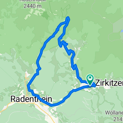
Overview
About this route
von ebene reichenau kurz flach dann der erste kurze anstieg (200m) bis zur abzeigung nockalmstrasse-turracher.
von hier an wird es mächtig steil. am anfang zwischen 10 und 14 % dann kurz etwas flacher (8-10 %haha).
beim verkehrsschild achtung steinschlag sieht man die wand vor sich.
23% steil!!!!!!( ca. 400 m) im sitzen kommt oft das vorderrad, im wiegetritt habe ich es nicht probiert.
bin noch nie so etwas steiles gefahren.
nach diesem monster geht es manierlich ( 10-13%) bis zur passhöhe, wo man am liebsten gleich in den see hüpfen würde.
- -:--
- Duration
- 9.7 km
- Distance
- 758 m
- Ascent
- 34 m
- Descent
- ---
- Avg. speed
- ---
- Max. altitude

Route quality
Waytypes & surfaces along the route
Waytypes
Busy road
9.2 km
(95 %)
Access road
0.4 km
(4 %)
Quiet road
0.1 km
(1 %)
Surfaces
Paved
9.2 km
(95 %)
Asphalt
9.2 km
(95 %)
Paved (undefined)
0 km
(<1 %)
Undefined
0.5 km
(5 %)
Continue with Bikemap
Use, edit, or download this cycling route
You would like to ride auf die Turracher Höhe or customize it for your own trip? Here is what you can do with this Bikemap route:
Free features
- Save this route as favorite or in collections
- Copy & plan your own version of this route
- Sync your route with Garmin or Wahoo
Premium features
Free trial for 3 days, or one-time payment. More about Bikemap Premium.
- Navigate this route on iOS & Android
- Export a GPX / KML file of this route
- Create your custom printout (try it for free)
- Download this route for offline navigation
Discover more Premium features.
Get Bikemap PremiumFrom our community
Other popular routes starting in Kleinkirchheim
 Genußrunde BKK
- Distance
- 28.7 km
- Ascent
- 1,986 m
- Descent
- 1,980 m
- Location
- Kleinkirchheim, Carinthia, Austria
 Gurkursprung-Tour
- Distance
- 27.8 km
- Ascent
- 1,030 m
- Descent
- 1,030 m
- Location
- Kleinkirchheim, Carinthia, Austria
 Bad Kleinkirchheim Runde
- Distance
- 34.4 km
- Ascent
- 1,126 m
- Descent
- 1,148 m
- Location
- Kleinkirchheim, Carinthia, Austria
 Mallnock- und Klommnockrunde
- Distance
- 13.8 km
- Ascent
- 1,170 m
- Descent
- 592 m
- Location
- Kleinkirchheim, Carinthia, Austria
 Nockalmstrasse
- Distance
- 33.1 km
- Ascent
- 1,396 m
- Descent
- 1,043 m
- Location
- Kleinkirchheim, Carinthia, Austria
 Über St. Oswald und die Totelitzen auf die Fronalm
- Distance
- 16.1 km
- Ascent
- 1,166 m
- Descent
- 1,168 m
- Location
- Kleinkirchheim, Carinthia, Austria
 14 st oswald
- Distance
- 32.1 km
- Ascent
- 1,068 m
- Descent
- 1,067 m
- Location
- Kleinkirchheim, Carinthia, Austria
 R3 ab Hotel 54km Osten-Süden 608HM
- Distance
- 55.3 km
- Ascent
- 741 m
- Descent
- 743 m
- Location
- Kleinkirchheim, Carinthia, Austria
Open it in the app