

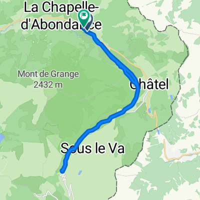
140 Route des Moulins, La Chapelle-d'Abondance to Route Forestière 42, Troistorrents
A cycling route starting in Châtel, Auvergne-Rhône-Alpes, France.
Overview
About this route
- 44 min
- Duration
- 16.5 km
- Distance
- 4,574 m
- Ascent
- 4,456 m
- Descent
- 22.4 km/h
- Avg. speed
- 1,387 m
- Max. altitude

Route quality
Waytypes & surfaces along the route
Waytypes
Track
4.1 km
(25 %)
Road
2.5 km
(15 %)
Surfaces
Paved
7.4 km
(45 %)
Unpaved
4 km
(24 %)
Asphalt
7.4 km
(45 %)
Unpaved (undefined)
2 km
(12 %)
Continue with Bikemap
Use, edit, or download this cycling route
You would like to ride 140 Route des Moulins, La Chapelle-d'Abondance to Route Forestière 42, Troistorrents or customize it for your own trip? Here is what you can do with this Bikemap route:
Free features
- Save this route as favorite or in collections
- Copy & plan your own version of this route
- Sync your route with Garmin or Wahoo
Premium features
Free trial for 3 days, or one-time payment. More about Bikemap Premium.
- Navigate this route on iOS & Android
- Export a GPX / KML file of this route
- Create your custom printout (try it for free)
- Download this route for offline navigation
Discover more Premium features.
Get Bikemap PremiumFrom our community
Other popular routes starting in Châtel
 140 Route des Moulins, La Chapelle-d'Abondance to Route Forestière 42, Troistorrents
- Distance
- 16.5 km
- Ascent
- 4,574 m
- Descent
- 4,456 m
- Location
- Châtel, Auvergne-Rhône-Alpes, France
 Col du Bassachaux
- Distance
- 14.7 km
- Ascent
- 752 m
- Descent
- 4 m
- Location
- Châtel, Auvergne-Rhône-Alpes, France
 Alpentour '98/Etappe 5: LaChapelle - Corbier - Joux Verte/Avoriaz - Corbier - LaChapelle
- Distance
- 92.9 km
- Ascent
- 2,089 m
- Descent
- 2,088 m
- Location
- Châtel, Auvergne-Rhône-Alpes, France
 wypad wloski cz.1
- Distance
- 94.4 km
- Ascent
- 2,483 m
- Descent
- 1,054 m
- Location
- Châtel, Auvergne-Rhône-Alpes, France
 La Chapelle-dÀbondance - Genf
- Distance
- 82.2 km
- Ascent
- 460 m
- Descent
- 1,122 m
- Location
- Châtel, Auvergne-Rhône-Alpes, France
 Abondance 100km mit See
- Distance
- 104.4 km
- Ascent
- 1,119 m
- Descent
- 1,119 m
- Location
- Châtel, Auvergne-Rhône-Alpes, France
 odcinek 1: La Chapelle-Bulle-Marly
- Distance
- 136.7 km
- Ascent
- 1,143 m
- Descent
- 1,529 m
- Location
- Châtel, Auvergne-Rhône-Alpes, France
 De D22 1432, La Chapelle-d'Abondance à D22 1154, La Chapelle-d'Abondance
- Distance
- 19 km
- Ascent
- 330 m
- Descent
- 324 m
- Location
- Châtel, Auvergne-Rhône-Alpes, France
Open it in the app