

Anniversary Trail - Capital City - Sandridge Rail Trail - Bay Trail - Long Beach Trail -Dandenong Creek - East Link Trail - Djerring Trail
A cycling route starting in Carnegie, Victoria, Australia.
Overview
About this route
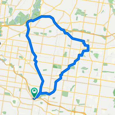
Distance: 99.5 KmMinimum Elevation: 5 MMaximum Elevation: 82 M
- -:--
- Duration
- 100 km
- Distance
- 529 m
- Ascent
- 531 m
- Descent
- ---
- Avg. speed
- 83 m
- Max. altitude

Route quality
Waytypes & surfaces along the route
Waytypes
Cycleway
93 km
(93 %)
Quiet road
2 km
(2 %)
Surfaces
Paved
80 km
(80 %)
Unpaved
14 km
(14 %)
Asphalt
42 km
(42 %)
Concrete
32 km
(32 %)
Continue with Bikemap
Use, edit, or download this cycling route
You would like to ride Anniversary Trail - Capital City - Sandridge Rail Trail - Bay Trail - Long Beach Trail -Dandenong Creek - East Link Trail - Djerring Trail or customize it for your own trip? Here is what you can do with this Bikemap route:
Free features
- Save this route as favorite or in collections
- Copy & plan your own version of this route
- Split it into stages to create a multi-day tour
- Sync your route with Garmin or Wahoo
Premium features
Free trial for 3 days, or one-time payment. More about Bikemap Premium.
- Navigate this route on iOS & Android
- Export a GPX / KML file of this route
- Create your custom printout (try it for free)
- Download this route for offline navigation
Discover more Premium features.
Get Bikemap PremiumFrom our community
Other popular routes starting in Carnegie
 Anniversary Trail - Capital City - Sandridge Rail Trail - Bay Trail - Long Beach Trail -Dandenong Creek - East Link Trail - Djerring Trail
- Distance
- 100 km
- Ascent
- 529 m
- Descent
- 531 m
- Location
- Carnegie, Victoria, Australia
 Rusty Ride V2
- Distance
- 87.2 km
- Ascent
- 279 m
- Descent
- 279 m
- Location
- Carnegie, Victoria, Australia
 Carnegie to Monash Medical Centre
- Distance
- 7.1 km
- Ascent
- 31 m
- Descent
- 8 m
- Location
- Carnegie, Victoria, Australia
 East Malvern to Syndal
- Distance
- 21.6 km
- Ascent
- 192 m
- Descent
- 115 m
- Location
- Carnegie, Victoria, Australia
 Recording from 9 Mar 2016, 7:51 AM
- Distance
- 16.6 km
- Ascent
- 100 m
- Descent
- 81 m
- Location
- Carnegie, Victoria, Australia
 Train_Wayne
- Distance
- 5.2 km
- Ascent
- 20 m
- Descent
- 5 m
- Location
- Carnegie, Victoria, Australia
 Jells Park loop
- Distance
- 44.6 km
- Ascent
- 162 m
- Descent
- 162 m
- Location
- Carnegie, Victoria, Australia
 East Malvern. Blackburn, Ivanhoe & return
- Distance
- 36.2 km
- Ascent
- 179 m
- Descent
- 178 m
- Location
- Carnegie, Victoria, Australia
Open it in the app