
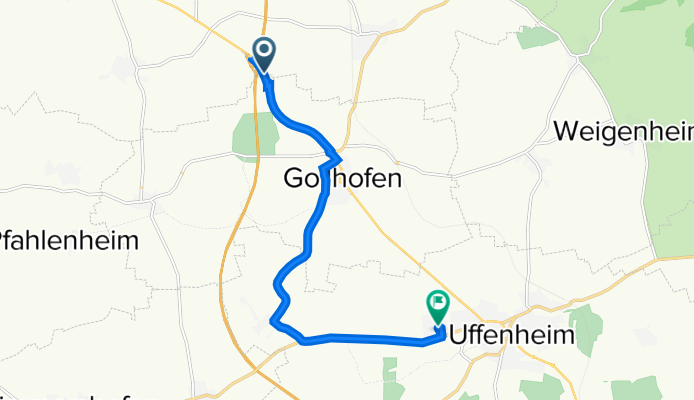
B13, Gollhofen nach Willy-Brandt-Straße 6A, Uffenheim
A cycling route starting in Gollhofen, Bavaria, Germany.
Overview
About this route
- 26 min
- Duration
- 9.7 km
- Distance
- 73 m
- Ascent
- 68 m
- Descent
- 22.1 km/h
- Avg. speed
- 348 m
- Max. altitude
Route quality
Waytypes & surfaces along the route
Waytypes
Quiet road
3.6 km
(37 %)
Track
2.9 km
(30 %)
Surfaces
Paved
5.9 km
(61 %)
Asphalt
4.9 km
(50 %)
Paved (undefined)
1 km
(11 %)
Undefined
3.8 km
(39 %)
Continue with Bikemap
Use, edit, or download this cycling route
You would like to ride B13, Gollhofen nach Willy-Brandt-Straße 6A, Uffenheim or customize it for your own trip? Here is what you can do with this Bikemap route:
Free features
- Save this route as favorite or in collections
- Copy & plan your own version of this route
- Sync your route with Garmin or Wahoo
Premium features
Free trial for 3 days, or one-time payment. More about Bikemap Premium.
- Navigate this route on iOS & Android
- Export a GPX / KML file of this route
- Create your custom printout (try it for free)
- Download this route for offline navigation
Discover more Premium features.
Get Bikemap PremiumFrom our community
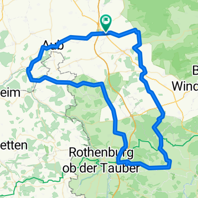
Other popular routes starting in Gollhofen
 1982_Altmühltal/Main_T6_Gollhofen_Volkach
- Distance
- 52.2 km
- Ascent
- 173 m
- Descent
- 291 m
- Location
- Gollhofen, Bavaria, Germany
 Steigerwald-Panorama-Weg-Tour
- Distance
- 67.7 km
- Ascent
- 571 m
- Descent
- 576 m
- Location
- Gollhofen, Bavaria, Germany
 RR 05/13Südlich um Gollhofen
- Distance
- 95.1 km
- Ascent
- 460 m
- Descent
- 457 m
- Location
- Gollhofen, Bavaria, Germany
 Gollhofen-Creglingen-Bieberehren-Aub-Gollhofen
- Distance
- 49.6 km
- Ascent
- 326 m
- Descent
- 326 m
- Location
- Gollhofen, Bavaria, Germany
 Gollhofen Radfahren
- Distance
- 22.6 km
- Ascent
- 158 m
- Descent
- 170 m
- Location
- Gollhofen, Bavaria, Germany
 Gollhofen-Ochsenfurt-Gaubahn-Gollhofen
- Distance
- 51.2 km
- Ascent
- 279 m
- Descent
- 279 m
- Location
- Gollhofen, Bavaria, Germany
 Dorfstraße 16, Gollhofen nach Lohrweg 5, Gallmersgarten
- Distance
- 20 km
- Ascent
- 198 m
- Descent
- 145 m
- Location
- Gollhofen, Bavaria, Germany
 Gollhofen, der Weg nach Westen (31,9 km)
- Distance
- 32 km
- Ascent
- 271 m
- Descent
- 271 m
- Location
- Gollhofen, Bavaria, Germany
Open it in the app