

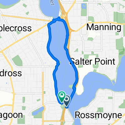
Bateman Kardinya Murdoch Ward, Bateman to 4 The Esplanade, Mount Pleasant
A cycling route starting in Mount Pleasant, Western Australia, Australia.
Overview
About this route
- 2 h 11 min
- Duration
- 25.4 km
- Distance
- 109 m
- Ascent
- 94 m
- Descent
- 11.6 km/h
- Avg. speed
- 18 m
- Max. altitude

Route quality
Waytypes & surfaces along the route
Waytypes
Cycleway
20.3 km
(80 %)
Path
3.6 km
(14 %)
Surfaces
Paved
22.8 km
(90 %)
Asphalt
21.1 km
(83 %)
Concrete
1.3 km
(5 %)
Continue with Bikemap
Use, edit, or download this cycling route
You would like to ride Bateman Kardinya Murdoch Ward, Bateman to 4 The Esplanade, Mount Pleasant or customize it for your own trip? Here is what you can do with this Bikemap route:
Free features
- Save this route as favorite or in collections
- Copy & plan your own version of this route
- Sync your route with Garmin or Wahoo
Premium features
Free trial for 3 days, or one-time payment. More about Bikemap Premium.
- Navigate this route on iOS & Android
- Export a GPX / KML file of this route
- Create your custom printout (try it for free)
- Download this route for offline navigation
Discover more Premium features.
Get Bikemap PremiumFrom our community
Other popular routes starting in Mount Pleasant
 The Esplanade, Mount Pleasant to The Esplanade, Mount Pleasant
- Distance
- 7.2 km
- Ascent
- 15 m
- Descent
- 15 m
- Location
- Mount Pleasant, Western Australia, Australia
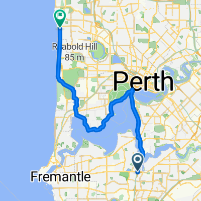
 Southern lakes v2
- Distance
- 33.4 km
- Ascent
- 256 m
- Descent
- 259 m
- Location
- Mount Pleasant, Western Australia, Australia
 Bateman Kardinya Murdoch Ward, Bateman to 4 The Esplanade, Mount Pleasant
- Distance
- 25.4 km
- Ascent
- 109 m
- Descent
- 94 m
- Location
- Mount Pleasant, Western Australia, Australia
 Lengthy bike tour through Bateman
- Distance
- 50.2 km
- Ascent
- 149 m
- Descent
- 148 m
- Location
- Mount Pleasant, Western Australia, Australia
 Bull Creek to Scarborough
- Distance
- 33.5 km
- Ascent
- 121 m
- Descent
- 113 m
- Location
- Mount Pleasant, Western Australia, Australia
 Canning Diversion 1
- Distance
- 30.9 km
- Ascent
- 173 m
- Descent
- 173 m
- Location
- Mount Pleasant, Western Australia, Australia
 crown route
- Distance
- 19.8 km
- Ascent
- 71 m
- Descent
- 71 m
- Location
- Mount Pleasant, Western Australia, Australia
 Perth Freemantle loop
- Distance
- 68.8 km
- Ascent
- 156 m
- Descent
- 163 m
- Location
- Mount Pleasant, Western Australia, Australia
Open it in the app