

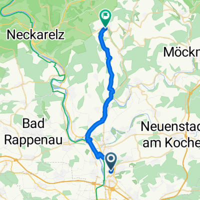
am Neckar runter und wieder rauf
A cycling route starting in Neckarsulm, Baden-Wurttemberg, Germany.
Overview
About this route
- -:--
- Duration
- 26.5 km
- Distance
- 80 m
- Ascent
- 79 m
- Descent
- ---
- Avg. speed
- 212 m
- Max. altitude

Route photos


Route quality
Waytypes & surfaces along the route
Waytypes
Track
11.6 km
(44 %)
Path
6.4 km
(24 %)
Surfaces
Paved
23.3 km
(88 %)
Unpaved
1.3 km
(5 %)
Asphalt
22.8 km
(86 %)
Ground
1.1 km
(4 %)
Continue with Bikemap
Use, edit, or download this cycling route
You would like to ride am Neckar runter und wieder rauf or customize it for your own trip? Here is what you can do with this Bikemap route:
Free features
- Save this route as favorite or in collections
- Copy & plan your own version of this route
- Sync your route with Garmin or Wahoo
Premium features
Free trial for 3 days, or one-time payment. More about Bikemap Premium.
- Navigate this route on iOS & Android
- Export a GPX / KML file of this route
- Create your custom printout (try it for free)
- Download this route for offline navigation
Discover more Premium features.
Get Bikemap PremiumFrom our community
Other popular routes starting in Neckarsulm
 Breitenauersee
- Distance
- 50 km
- Ascent
- 1,654 m
- Descent
- 1,668 m
- Location
- Neckarsulm, Baden-Wurttemberg, Germany
 NSU-Straße, Neckarsulm nach An der Steige, Billigheim
- Distance
- 22.8 km
- Ascent
- 261 m
- Descent
- 146 m
- Location
- Neckarsulm, Baden-Wurttemberg, Germany
 NSU - Löwenstein - Platte - Willsbach - Ellhofen - NSU
- Distance
- 44.3 km
- Ascent
- 677 m
- Descent
- 668 m
- Location
- Neckarsulm, Baden-Wurttemberg, Germany
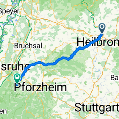 002 Neckarsulm 2 nahe KA
- Distance
- 79.3 km
- Ascent
- 1,081 m
- Descent
- 1,002 m
- Location
- Neckarsulm, Baden-Wurttemberg, Germany
 Gentex tour
- Distance
- 23.3 km
- Ascent
- 302 m
- Descent
- 302 m
- Location
- Neckarsulm, Baden-Wurttemberg, Germany
 Abendrunde
- Distance
- 26 km
- Ascent
- 164 m
- Descent
- 162 m
- Location
- Neckarsulm, Baden-Wurttemberg, Germany
 NSU - Schwabbach - NSU
- Distance
- 38.1 km
- Ascent
- 530 m
- Descent
- 430 m
- Location
- Neckarsulm, Baden-Wurttemberg, Germany
 Abendrunde
- Distance
- 26 km
- Ascent
- 173 m
- Descent
- 171 m
- Location
- Neckarsulm, Baden-Wurttemberg, Germany
Open it in the app