

Trip vélo Cantal - Corrèze 2011
A cycling route starting in Riom-ès-Montagnes, Auvergne-Rhône-Alpes, France.
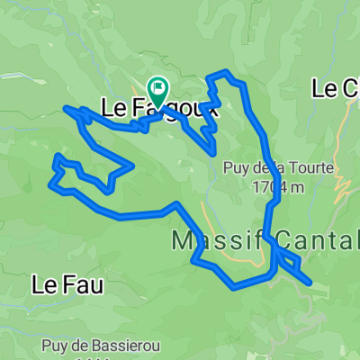
Overview
About this route
- -:--
- Duration
- 299.2 km
- Distance
- 2,021 m
- Ascent
- 2,021 m
- Descent
- ---
- Avg. speed
- ---
- Max. altitude

Route quality
Waytypes & surfaces along the route
Waytypes
Busy road
169.1 km
(57 %)
Road
90.5 km
(30 %)
Surfaces
Paved
128 km
(43 %)
Unpaved
0.6 km
(<1 %)
Asphalt
127.2 km
(43 %)
Paved (undefined)
0.7 km
(<1 %)
Route highlights
Points of interest along the route
Point of interest after 47.3 km
Etape 1 - Riom-ès-Montagnes / Neuvic
Point of interest after 98.4 km
Etape 2 - Neuvic / La Roche Canillac
Point of interest after 150 km
Etape 3 - La Roche Canillac / Collonges-la-Rouge
Point of interest after 198.5 km
Etape 4 - Collonges-la-Rouge / Argentat
Point of interest after 230.6 km
Etape 5 - Argentat / Pleaux
Point of interest after 255 km
Etape 6 - Pleaux / Lavaurs
Point of interest after 296.6 km
Etape 7 - Lavaurs / Riom-ès-Montagnes
Continue with Bikemap
Use, edit, or download this cycling route
You would like to ride Trip vélo Cantal - Corrèze 2011 or customize it for your own trip? Here is what you can do with this Bikemap route:
Free features
- Save this route as favorite or in collections
- Copy & plan your own version of this route
- Split it into stages to create a multi-day tour
- Sync your route with Garmin or Wahoo
Premium features
Free trial for 3 days, or one-time payment. More about Bikemap Premium.
- Navigate this route on iOS & Android
- Export a GPX / KML file of this route
- Create your custom printout (try it for free)
- Download this route for offline navigation
Discover more Premium features.
Get Bikemap PremiumFrom our community
Other popular routes starting in Riom-ès-Montagnes
 Cantal 2022 circuit N°1 - 43km samedi aprem
- Distance
- 43.2 km
- Ascent
- 951 m
- Descent
- 954 m
- Location
- Riom-ès-Montagnes, Auvergne-Rhône-Alpes, France
 2019-26 Riom-ès-Montagnes to Aurillac
- Distance
- 84.9 km
- Ascent
- 1,008 m
- Descent
- 1,223 m
- Location
- Riom-ès-Montagnes, Auvergne-Rhône-Alpes, France
 4.etapa Riom-es-Montagnes - Saint-Cirgues-De-Jordanne
- Distance
- 84.3 km
- Ascent
- 1,474 m
- Descent
- 1,454 m
- Location
- Riom-ès-Montagnes, Auvergne-Rhône-Alpes, France
 Cantal2022 N°3 104km 2400 D+
- Distance
- 103.6 km
- Ascent
- 2,418 m
- Descent
- 2,416 m
- Location
- Riom-ès-Montagnes, Auvergne-Rhône-Alpes, France
 Le Puy Mary (1783m) et la vallée du Falgoux par les crêtes
- Distance
- 43.9 km
- Ascent
- 1,933 m
- Descent
- 1,934 m
- Location
- Riom-ès-Montagnes, Auvergne-Rhône-Alpes, France
 12. Etappe: Condat über Pas de Peyrol
- Distance
- 52.6 km
- Ascent
- 1,064 m
- Descent
- 1,154 m
- Location
- Riom-ès-Montagnes, Auvergne-Rhône-Alpes, France
 Cantal 2022 N°1 bis 61km
- Distance
- 60.9 km
- Ascent
- 1,396 m
- Descent
- 1,397 m
- Location
- Riom-ès-Montagnes, Auvergne-Rhône-Alpes, France
 Plateau de Trizac -1568-Utagawa
- Distance
- 40 km
- Ascent
- 946 m
- Descent
- 948 m
- Location
- Riom-ès-Montagnes, Auvergne-Rhône-Alpes, France
Open it in the app