
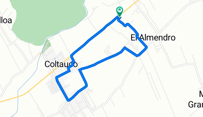
De Rosita elizondo 1, Almendro a Rosita elizondo 1, Almendro
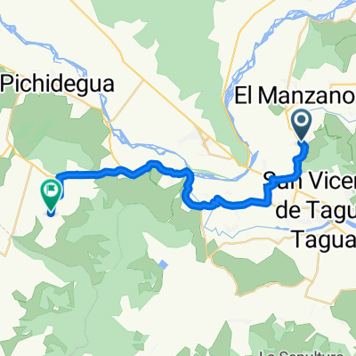
A cycling route starting in San Vicente, Región del Libertador General Bernardo O’Higgins, Chile.
Overview
About this route
- 25 min
- Duration
- 6 km
- Distance
- 66 m
- Ascent
- 92 m
- Descent
- 14.2 km/h
- Avg. speed
- 300 m
- Max. altitude

Route quality
Waytypes & surfaces along the route
Waytypes
Road
2.8 km
(47 %)
Quiet road
2.1 km
(35 %)
Surfaces
Paved
3.9 km
(65 %)
Asphalt
2.4 km
(40 %)
Paved (undefined)
1.5 km
(25 %)
Undefined
2.1 km
(35 %)
Continue with Bikemap
Use, edit, or download this cycling route
You would like to ride De Rosita elizondo 1, Almendro a Rosita elizondo 1, Almendro or customize it for your own trip? Here is what you can do with this Bikemap route:
Free features
- Save this route as favorite or in collections
- Copy & plan your own version of this route
- Sync your route with Garmin or Wahoo
Premium features
Free trial for 3 days, or one-time payment. More about Bikemap Premium.
- Navigate this route on iOS & Android
- Export a GPX / KML file of this route
- Create your custom printout (try it for free)
- Download this route for offline navigation
Discover more Premium features.
Get Bikemap PremiumFrom our community
Other popular routes starting in San Vicente
 Tunca El Medio - El Salto de Almahue
- Distance
- 28.8 km
- Ascent
- 206 m
- Descent
- 277 m
- Location
- San Vicente, Región del Libertador General Bernardo O’Higgins, Chile
 De Peumo a Avenida España 1536, San Vicente de Taguatagua
- Distance
- 13.7 km
- Ascent
- 117 m
- Descent
- 87 m
- Location
- San Vicente, Región del Libertador General Bernardo O’Higgins, Chile
 sn vicente hasta laguna sn vicente..
- Distance
- 24 km
- Ascent
- 92 m
- Descent
- 92 m
- Location
- San Vicente, Región del Libertador General Bernardo O’Higgins, Chile
 De H-50, Quinta de Tilcoco a H-574, Quinta de Tilcoco
- Distance
- 106.8 km
- Ascent
- 449 m
- Descent
- 454 m
- Location
- San Vicente, Región del Libertador General Bernardo O’Higgins, Chile
 De Camino Alto del Huesillo, San Vicente de Tagua Tagua a Camino Alto del Huesillo, San Vicente de Tagua Tagua
- Distance
- 11.7 km
- Ascent
- 373 m
- Descent
- 375 m
- Location
- San Vicente, Región del Libertador General Bernardo O’Higgins, Chile
 De Calle A. Gines Yáñez 104, San Vicente de Taguatagua a Aguas Claras 318, Peumo
- Distance
- 13.6 km
- Ascent
- 109 m
- Descent
- 141 m
- Location
- San Vicente, Región del Libertador General Bernardo O’Higgins, Chile
 De H-574 760, Quinta de Tilcoco a H-574 760, Quinta de Tilcoco
- Distance
- 22.9 km
- Ascent
- 265 m
- Descent
- 277 m
- Location
- San Vicente, Región del Libertador General Bernardo O’Higgins, Chile
 parquímetros
- Distance
- 14.1 km
- Ascent
- 20 m
- Descent
- 22 m
- Location
- San Vicente, Región del Libertador General Bernardo O’Higgins, Chile
Open it in the app