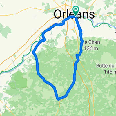
LOIRET - SUD - 92 kms
- 92.2 km
- 287 m
- 288 m
- Saint-Jean-le-Blanc, Centre-Val de Loire, France
A cycling route starting in Saint-Jean-le-Blanc, Centre-Val de Loire, France.
Overview
Orleans - Boigny - Mardié - Donnery - Fay - Ingrannes - Courcy (pause at the pond) - Mareau - Laas - Escrennes - Pithivier le viel - Greneville - Chatillon le Roi - Jouy en Pithiverais - dir Attray - Crtte en Pithiverais - Neuville - Loury - Golf - Rebréchien - Chanteau - semoy - Orleans
created this 2 years ago
Route quality
Road
46.8 km
(40 %)
Quiet road
29.2 km
(25 %)
Paved
54.9 km
(47 %)
Asphalt
54.9 km
(47 %)
Undefined
62 km
(53 %)
Route highlights
PAUSE à l'étang km 45,5
Continue with Bikemap
You would like to ride LOIRET Nord - 117kms - Phithiviers le Viel or customize it for your own trip? Here is what you can do with this Bikemap route:
Free trial for 3 days, or one-time payment. More about Bikemap Premium.
Discover more Premium features.
Get Bikemap PremiumFrom our community
Open it in the app