

Anduze - Avignon
A cycling route starting in Anduze, Languedoc-Roussillon-Midi-Pyrénées, France.
Overview
About this route
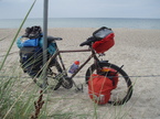
Dem Gard entlang auf Nebenwegen, Weintrauben überall. Bei Collias Abstecher zu einem lieblichen Badeplatz nicht verpassen! Pont du Gard muss (darf) man gesehen haben. Ziel, Camping Bagatelle in Avignon mit wunderbarer Sicht auf die Stadt.
- -:--
- Duration
- 98.3 km
- Distance
- 304 m
- Ascent
- 420 m
- Descent
- ---
- Avg. speed
- ---
- Max. altitude
Route quality
Waytypes & surfaces along the route
Waytypes
Road
43.5 km
(44 %)
Quiet road
23.5 km
(24 %)
Surfaces
Paved
21.5 km
(22 %)
Unpaved
5 km
(5 %)
Asphalt
19.3 km
(20 %)
Gravel
3.9 km
(4 %)
Continue with Bikemap
Use, edit, or download this cycling route
You would like to ride Anduze - Avignon or customize it for your own trip? Here is what you can do with this Bikemap route:
Free features
- Save this route as favorite or in collections
- Copy & plan your own version of this route
- Split it into stages to create a multi-day tour
- Sync your route with Garmin or Wahoo
Premium features
Free trial for 3 days, or one-time payment. More about Bikemap Premium.
- Navigate this route on iOS & Android
- Export a GPX / KML file of this route
- Create your custom printout (try it for free)
- Download this route for offline navigation
Discover more Premium features.
Get Bikemap PremiumFrom our community
Other popular routes starting in Anduze
 Rund um den Mont Brion
- Distance
- 47.5 km
- Ascent
- 554 m
- Descent
- 543 m
- Location
- Anduze, Languedoc-Roussillon-Midi-Pyrénées, France
 Corniche des Cevennes - Vallée Francaise
- Distance
- 101.4 km
- Ascent
- 1,101 m
- Descent
- 1,103 m
- Location
- Anduze, Languedoc-Roussillon-Midi-Pyrénées, France
 Anduze - Florac Tour Nr. 163 (Südwest)
- Distance
- 64.6 km
- Ascent
- 1,159 m
- Descent
- 746 m
- Location
- Anduze, Languedoc-Roussillon-Midi-Pyrénées, France
 Anduze Col de St. Pierre
- Distance
- 57.5 km
- Ascent
- 741 m
- Descent
- 741 m
- Location
- Anduze, Languedoc-Roussillon-Midi-Pyrénées, France
 Test Ardeche
- Distance
- 85.6 km
- Ascent
- 1,239 m
- Descent
- 1,265 m
- Location
- Anduze, Languedoc-Roussillon-Midi-Pyrénées, France
 Anduze - Avignon
- Distance
- 98.3 km
- Ascent
- 304 m
- Descent
- 420 m
- Location
- Anduze, Languedoc-Roussillon-Midi-Pyrénées, France
 Anduze-Col du Rédarès-St.Hyppolite-Valflaunès-Quissac-Lézan-Anduzes
- Distance
- 95.4 km
- Ascent
- 738 m
- Descent
- 738 m
- Location
- Anduze, Languedoc-Roussillon-Midi-Pyrénées, France
 col du Mercou-col de l'Asclier
- Distance
- 95.4 km
- Ascent
- 1,654 m
- Descent
- 1,654 m
- Location
- Anduze, Languedoc-Roussillon-Midi-Pyrénées, France
Open it in the app