

Égletons to Bort-les-Orgues
A cycling route starting in Égletons, Nouvelle-Aquitaine, France.
Overview
About this route
Because of weather forecasts for thunder, lightning, and heavy rain, we took D1089 and D979, which are main roads, instead of the smaller roads that would have been preferable. Neither road had much shoulder, but with the relatively light traffic, it wasn’t a problem.
- 4 h 13 min
- Duration
- 51.4 km
- Distance
- 769 m
- Ascent
- 968 m
- Descent
- 12.2 km/h
- Avg. speed
- 713 m
- Max. altitude

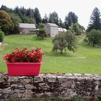
Route photos


Route quality
Waytypes & surfaces along the route
Waytypes
Quiet road
1.5 km
(3 %)
Road
0.5 km
(1 %)
Undefined
49.3 km
(96 %)
Surfaces
Paved
45.2 km
(88 %)
Asphalt
45.2 km
(88 %)
Undefined
6.2 km
(12 %)
Continue with Bikemap
Use, edit, or download this cycling route
You would like to ride Égletons to Bort-les-Orgues or customize it for your own trip? Here is what you can do with this Bikemap route:
Free features
- Save this route as favorite or in collections
- Copy & plan your own version of this route
- Sync your route with Garmin or Wahoo
Premium features
Free trial for 3 days, or one-time payment. More about Bikemap Premium.
- Navigate this route on iOS & Android
- Export a GPX / KML file of this route
- Create your custom printout (try it for free)
- Download this route for offline navigation
Discover more Premium features.
Get Bikemap PremiumFrom our community
Other popular routes starting in Égletons
 Égletons to Bort-les-Orgues
- Distance
- 51.4 km
- Ascent
- 769 m
- Descent
- 968 m
- Location
- Égletons, Nouvelle-Aquitaine, France
 Égletons bis Clermont-Ferrand optimiert
- Distance
- 125.5 km
- Ascent
- 2,153 m
- Descent
- 2,363 m
- Location
- Égletons, Nouvelle-Aquitaine, France
 Vichy - Perpignan 1996 Etappe 6
- Distance
- 55.5 km
- Ascent
- 542 m
- Descent
- 876 m
- Location
- Égletons, Nouvelle-Aquitaine, France
 Égletons - Circle by Darnets
- Distance
- 24.2 km
- Ascent
- 449 m
- Descent
- 451 m
- Location
- Égletons, Nouvelle-Aquitaine, France
 Marcillac-la-Croisille to Bugeat - V87
- Distance
- 70.3 km
- Ascent
- 1,015 m
- Descent
- 948 m
- Location
- Égletons, Nouvelle-Aquitaine, France
 MARCILLAC LA CROISILLE - LAC DE VIAM
- Distance
- 54.4 km
- Ascent
- 608 m
- Descent
- 491 m
- Location
- Égletons, Nouvelle-Aquitaine, France
 Égletons - Circle to Lamazière-Basse
- Distance
- 35.3 km
- Ascent
- 654 m
- Descent
- 655 m
- Location
- Égletons, Nouvelle-Aquitaine, France
 Égletons - Circle to the North through Péret-Bel-Air, Commerly, and St.-Yrieix-le-Déjalat
- Distance
- 49.9 km
- Ascent
- 909 m
- Descent
- 916 m
- Location
- Égletons, Nouvelle-Aquitaine, France
Open it in the app