

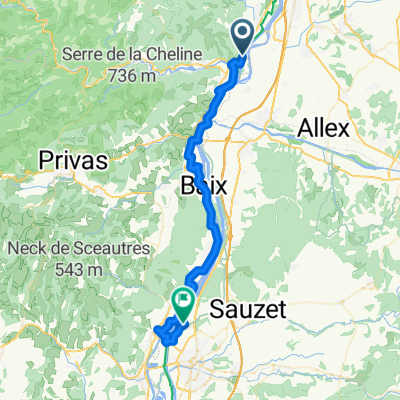
Beauchastel à D 86, La Voulte-sur-Rhône
A cycling route starting in Beauchastel, Auvergne-Rhône-Alpes, France.
Overview
About this route
- 19 min
- Duration
- 3.2 km
- Distance
- 102 m
- Ascent
- 103 m
- Descent
- 10.2 km/h
- Avg. speed
- 101 m
- Max. altitude

Route quality
Waytypes & surfaces along the route
Waytypes
Path
1.7 km
(52 %)
Cycleway
1.2 km
(37 %)
Surfaces
Paved
2.5 km
(78 %)
Unpaved
0.7 km
(21 %)
Asphalt
2.5 km
(77 %)
Loose gravel
0.4 km
(13 %)
Continue with Bikemap
Use, edit, or download this cycling route
You would like to ride Beauchastel à D 86, La Voulte-sur-Rhône or customize it for your own trip? Here is what you can do with this Bikemap route:
Free features
- Save this route as favorite or in collections
- Copy & plan your own version of this route
- Sync your route with Garmin or Wahoo
Premium features
Free trial for 3 days, or one-time payment. More about Bikemap Premium.
- Navigate this route on iOS & Android
- Export a GPX / KML file of this route
- Create your custom printout (try it for free)
- Download this route for offline navigation
Discover more Premium features.
Get Bikemap PremiumFrom our community
Other popular routes starting in Beauchastel
 Via Rhona, Beauchastel à Chemin de l'Île Blanc, Rochemaure
- Distance
- 45.2 km
- Ascent
- 125 m
- Descent
- 156 m
- Location
- Beauchastel, Auvergne-Rhône-Alpes, France
 le pouzin, vernoux et retour
- Distance
- 58.4 km
- Ascent
- 1,371 m
- Descent
- 1,371 m
- Location
- Beauchastel, Auvergne-Rhône-Alpes, France
 Szprycha wzdłuż Rodanu do Lazurowego Wybrzeża - 10.07.2016 r.
- Distance
- 37.3 km
- Ascent
- 83 m
- Descent
- 106 m
- Location
- Beauchastel, Auvergne-Rhône-Alpes, France
 La Voulte - Le Puy
- Distance
- 127 km
- Ascent
- 1,652 m
- Descent
- 1,155 m
- Location
- Beauchastel, Auvergne-Rhône-Alpes, France
 6 Route du Pont, Beauchastel naar 1 Chemin des Sportifs, Soyons
- Distance
- 12.8 km
- Ascent
- 69 m
- Descent
- 59 m
- Location
- Beauchastel, Auvergne-Rhône-Alpes, France
 VB to Olières
- Distance
- 17.9 km
- Ascent
- 173 m
- Descent
- 69 m
- Location
- Beauchastel, Auvergne-Rhône-Alpes, France
 2o16-10-30 voie douce de Privas Chomérac
- Distance
- 45.6 km
- Ascent
- 199 m
- Descent
- 164 m
- Location
- Beauchastel, Auvergne-Rhône-Alpes, France
 Beauchastel - Pont-Saint-Esprit
- Distance
- 81.5 km
- Ascent
- 145 m
- Descent
- 194 m
- Location
- Beauchastel, Auvergne-Rhône-Alpes, France
Open it in the app