

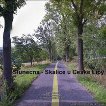
2005-05-16 Vysoká Lípa-Hinterhermsdorf-Kyjov-Doubice-V.L
A cycling route starting in Česká Kamenice, Ústecký kraj, Czechia.
Overview
About this route
Čím více zde napíšete informací, tím více bude užitečnější pro ostatním uživatele.<br /><br />* Průběh trasy.<br />* Co je zvláštní na této trase?<br />* Proč doporučit tuto trasu?<br />* Co se Vám zde nejvíce líbilo?<br />* Atd.
- -:--
- Duration
- 40 km
- Distance
- 625 m
- Ascent
- 631 m
- Descent
- ---
- Avg. speed
- 438 m
- Max. altitude

Route quality
Waytypes & surfaces along the route
Waytypes
Road
18.2 km
(45 %)
Track
18.1 km
(45 %)
Surfaces
Paved
22.9 km
(57 %)
Unpaved
10.1 km
(25 %)
Asphalt
22.2 km
(56 %)
Gravel
8.2 km
(21 %)
Continue with Bikemap
Use, edit, or download this cycling route
You would like to ride 2005-05-16 Vysoká Lípa-Hinterhermsdorf-Kyjov-Doubice-V.L or customize it for your own trip? Here is what you can do with this Bikemap route:
Free features
- Save this route as favorite or in collections
- Copy & plan your own version of this route
- Sync your route with Garmin or Wahoo
Premium features
Free trial for 3 days, or one-time payment. More about Bikemap Premium.
- Navigate this route on iOS & Android
- Export a GPX / KML file of this route
- Create your custom printout (try it for free)
- Download this route for offline navigation
Discover more Premium features.
Get Bikemap PremiumFrom our community
Other popular routes starting in Česká Kamenice
 2005-05-16 Vysoká Lípa-Hinterhermsdorf-Kyjov-Doubice-V.L
- Distance
- 40 km
- Ascent
- 625 m
- Descent
- 631 m
- Location
- Česká Kamenice, Ústecký kraj, Czechia
 Fofr Cup - MTB marathon
- Distance
- 29.8 km
- Ascent
- 603 m
- Descent
- 603 m
- Location
- Česká Kamenice, Ústecký kraj, Czechia
 Svobodak - kopce
- Distance
- 128.3 km
- Ascent
- 1,473 m
- Descent
- 1,458 m
- Location
- Česká Kamenice, Ústecký kraj, Czechia
 4. Panská skála - Ještěd
- Distance
- 50.5 km
- Ascent
- 782 m
- Descent
- 400 m
- Location
- Česká Kamenice, Ústecký kraj, Czechia
 České Švýcarsko - z Jetřichovic přes Doubice do Vysoké Lípy a zpět
- Distance
- 31.5 km
- Ascent
- 515 m
- Descent
- 517 m
- Location
- Česká Kamenice, Ústecký kraj, Czechia
 Grundmühle (Tour mit Veit)
- Distance
- 68.7 km
- Ascent
- 775 m
- Descent
- 773 m
- Location
- Česká Kamenice, Ústecký kraj, Czechia
 Testovací č.1
- Distance
- 20.1 km
- Ascent
- 190 m
- Descent
- 193 m
- Location
- Česká Kamenice, Ústecký kraj, Czechia
 České Švýcarsko 02
- Distance
- 56.2 km
- Ascent
- 434 m
- Descent
- 434 m
- Location
- Česká Kamenice, Ústecký kraj, Czechia
Open it in the app