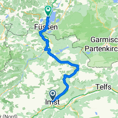
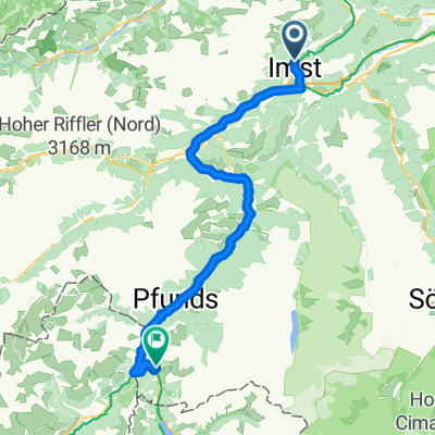
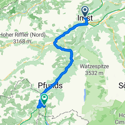
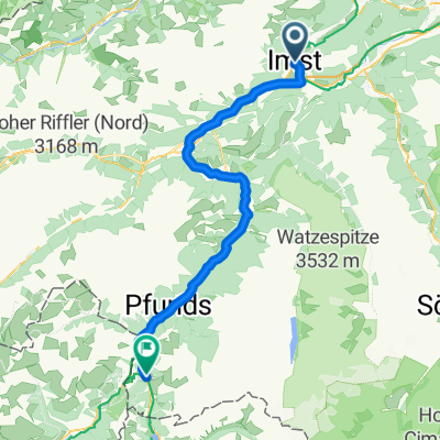
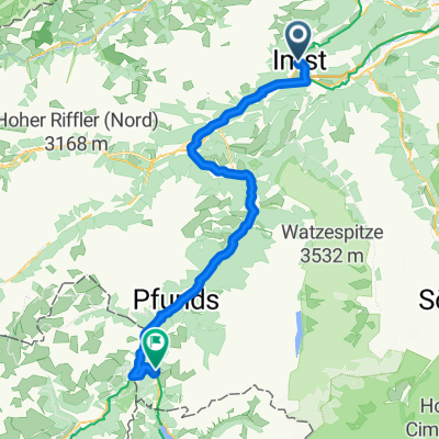
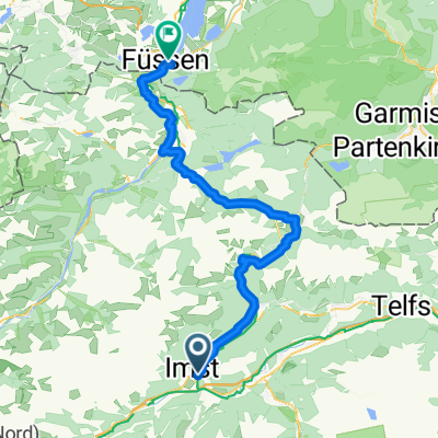
Transalpine (3) Imst - Scuol
A cycling route starting in Imst, Tyrol, Austria.
Overview
About this route
Dritte Etappe der transalpine Radtour von Zangberg nach Grenoble. Hier wird es richtig schön. Der Radweg ist -außer auf den ersten Kilometern- weit genug von Autobahnen und Hauptstraßen entfernt. Für eine kleine, überwindbare Überraschung (Steil+Schotter) für den Trekkingfahrer ist gesorgt.
- -:--
- Duration
- 84.3 km
- Distance
- 761 m
- Ascent
- 290 m
- Descent
- ---
- Avg. speed
- ---
- Avg. speed
Route highlights
Points of interest along the route
Point of interest after 69.2 km
In diesem Bereich Schotter und starke Steigungen in Reiserichtung Scuol. Der Streckenverlauf ist nicht optimal eingezeichnet, da die Route im Wald verläuft und dadurch in Google Earth unsichtbar ist. Im Gelände ist der Radweg jedoch klar zu erkennen.
Point of interest after 83 km
Magnesiumhaltiges Quellwasser als Fitnesdrunk
Continue with Bikemap
Use, edit, or download this cycling route
You would like to ride Transalpine (3) Imst - Scuol or customize it for your own trip? Here is what you can do with this Bikemap route:
Free features
- Save this route as favorite or in collections
- Copy & plan your own version of this route
- Sync your route with Garmin or Wahoo
Premium features
Free trial for 3 days, or one-time payment. More about Bikemap Premium.
- Navigate this route on iOS & Android
- Export a GPX / KML file of this route
- Create your custom printout (try it for free)
- Download this route for offline navigation
Discover more Premium features.
Get Bikemap PremiumFrom our community
Other popular routes starting in Imst
- Fabrikstraße 34, Gemeinde Imst do Kronburg 105, Zammerberg
- Distance
- 13.7 km
- Ascent
- 321 m
- Descent
- 110 m
- Location
- Imst, Tyrol, Austria
- Via Claudia Augusta 4. Imst - Cusio
- Distance
- 89.2 km
- Ascent
- 2,037 m
- Descent
- 1,916 m
- Location
- Imst, Tyrol, Austria
- Etappe 2 | Imst bis Nauders
- Distance
- 73 km
- Ascent
- 2,187 m
- Descent
- 1,643 m
- Location
- Imst, Tyrol, Austria
- Kühtai
- Distance
- 101.2 km
- Ascent
- 1,672 m
- Descent
- 1,672 m
- Location
- Imst, Tyrol, Austria
- Via Claudia Tag 2
- Distance
- 72.7 km
- Ascent
- 933 m
- Descent
- 408 m
- Location
- Imst, Tyrol, Austria
- Imst - Dorf Tirol via Timmelsjoch
- Distance
- 119.4 km
- Ascent
- 2,076 m
- Descent
- 2,206 m
- Location
- Imst, Tyrol, Austria
- Ischgl/Hahntennjoch/Nassenreith/Landeck/Ischgl
- Distance
- 101 km
- Ascent
- 2,068 m
- Descent
- 2,072 m
- Location
- Imst, Tyrol, Austria
- Alpenpässe-Warmfahrrunde
- Distance
- 278.5 km
- Ascent
- 4,462 m
- Descent
- 3,826 m
- Location
- Imst, Tyrol, Austria
Open it in the app