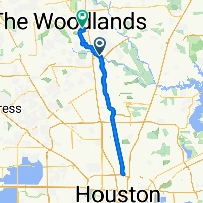
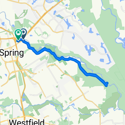
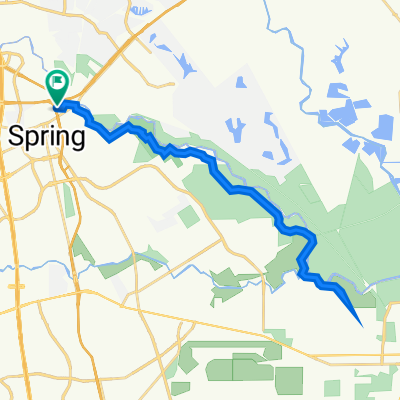
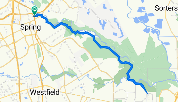
Hardy Toll Road N, Spring to Hardy Toll Road N, Spring
A cycling route starting in Spring, Texas, United States.
Overview
About this route
- 1 h 51 min
- Duration
- 35.3 km
- Distance
- 163 m
- Ascent
- 166 m
- Descent
- 19 km/h
- Avg. speed
- 37 m
- Max. altitude
Route quality
Waytypes & surfaces along the route
Waytypes
Cycleway
34.2 km
(97 %)
Path
0.7 km
(2 %)
Access road
0.4 km
(1 %)
Surfaces
Paved
34.2 km
(97 %)
Asphalt
33.9 km
(96 %)
Concrete
0.4 km
(1 %)
Undefined
1.1 km
(3 %)
Continue with Bikemap
Use, edit, or download this cycling route
You would like to ride Hardy Toll Road N, Spring to Hardy Toll Road N, Spring or customize it for your own trip? Here is what you can do with this Bikemap route:
Free features
- Save this route as favorite or in collections
- Copy & plan your own version of this route
- Sync your route with Garmin or Wahoo
Premium features
Free trial for 3 days, or one-time payment. More about Bikemap Premium.
- Navigate this route on iOS & Android
- Export a GPX / KML file of this route
- Create your custom printout (try it for free)
- Download this route for offline navigation
Discover more Premium features.
Get Bikemap PremiumFrom our community
Other popular routes starting in Spring
10 miles- Distance
- 34 km
- Ascent
- 827 m
- Descent
- 830 m
- Location
- Spring, Texas, United States
Dennis Johnston Park- Distance
- 42.7 km
- Ascent
- 227 m
- Descent
- 227 m
- Location
- Spring, Texas, United States
Hardy Toll Road N, Spring to Hardy Toll Road N, Spring- Distance
- 35.3 km
- Ascent
- 163 m
- Descent
- 166 m
- Location
- Spring, Texas, United States
Winding Ridge Dr, Spring to T C Jester Blvd, Spring- Distance
- 16.4 km
- Ascent
- 19 m
- Descent
- 15 m
- Location
- Spring, Texas, United States
Exxon Mobile 17- Distance
- 13.4 km
- Ascent
- 56 m
- Descent
- 57 m
- Location
- Spring, Texas, United States
Vcc route- Distance
- 31.2 km
- Ascent
- 12 m
- Descent
- 12 m
- Location
- Spring, Texas, United States
Route from Spring Creek Greenway Trail, Spring- Distance
- 24 km
- Ascent
- 180 m
- Descent
- 178 m
- Location
- Spring, Texas, United States
Pundt Park to Jessie Jones and back- Distance
- 38.4 km
- Ascent
- 97 m
- Descent
- 63 m
- Location
- Spring, Texas, United States
Open it in the app

