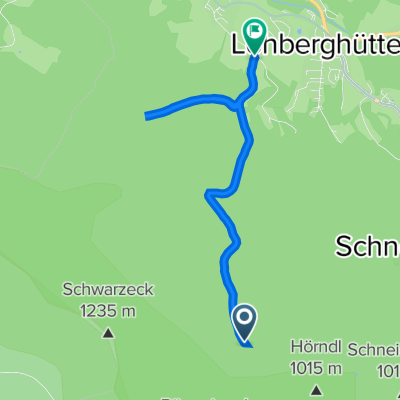
Lohberg - Modrava
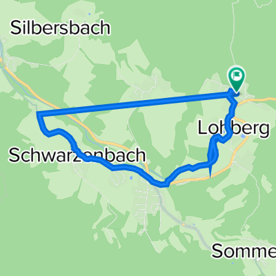
A cycling route starting in Lohberg, Bavaria, Germany.
Overview
About this route
- -:--
- Duration
- 58.9 km
- Distance
- 1,456 m
- Ascent
- 1,138 m
- Descent
- ---
- Avg. speed
- 1,206 m
- Max. altitude
Route quality
Waytypes & surfaces along the route
Waytypes
Road
18 km
(31 %)
Track
15.2 km
(26 %)
Surfaces
Paved
42.1 km
(71 %)
Unpaved
1.3 km
(2 %)
Asphalt
41.9 km
(71 %)
Gravel
0.9 km
(2 %)
Continue with Bikemap
Use, edit, or download this cycling route
You would like to ride Lohberg - Modrava or customize it for your own trip? Here is what you can do with this Bikemap route:
Free features
- Save this route as favorite or in collections
- Copy & plan your own version of this route
- Sync your route with Garmin or Wahoo
Premium features
Free trial for 3 days, or one-time payment. More about Bikemap Premium.
- Navigate this route on iOS & Android
- Export a GPX / KML file of this route
- Create your custom printout (try it for free)
- Download this route for offline navigation
Discover more Premium features.
Get Bikemap PremiumFrom our community
Other popular routes starting in Lohberg
- 970 Hm - Von Lohberg nach Kollnburg mit vielen Super-Trails
- Distance
- 52.5 km
- Ascent
- 817 m
- Descent
- 880 m
- Location
- Lohberg, Bavaria, Germany
- Ebensäge - Arber - Bodenmais - Neumühlen
- Distance
- 53.8 km
- Ascent
- 1,037 m
- Descent
- 1,336 m
- Location
- Lohberg, Bavaria, Germany
- Radrunde durch Lohberg
- Distance
- 28.2 km
- Ascent
- 455 m
- Descent
- 457 m
- Location
- Lohberg, Bavaria, Germany
- Ausfahrt durch Lohberg
- Distance
- 18.4 km
- Ascent
- 484 m
- Descent
- 482 m
- Location
- Lohberg, Bavaria, Germany
- ARBER-OSSER RUNDE
- Distance
- 31.6 km
- Ascent
- 1,128 m
- Descent
- 1,130 m
- Location
- Lohberg, Bavaria, Germany
- Lohberg - Modrava
- Distance
- 58.9 km
- Ascent
- 1,456 m
- Descent
- 1,138 m
- Location
- Lohberg, Bavaria, Germany
- Aufnahme vom 13.06.2017, 17:10
- Distance
- 23.1 km
- Ascent
- 657 m
- Descent
- 655 m
- Location
- Lohberg, Bavaria, Germany
- Arberhöhenzug
- Distance
- 38.3 km
- Ascent
- 1,502 m
- Descent
- 1,782 m
- Location
- Lohberg, Bavaria, Germany
Open it in the app