

Mangfall-Radweg
A cycling route starting in Munich, Bavaria, Germany.
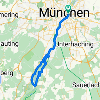
Overview
About this route
Der Radweg verbindet München mit Rosenheim und verläuft ab Feldkirchen-Westerham am Fluss Mangfall entlang. Die 63 km lange Strecke hat kaum Steigungen und lockt immer wieder mit schönen Plätzen zum Rasten.
- 4 h 38 min
- Duration
- 63.6 km
- Distance
- 168 m
- Ascent
- 256 m
- Descent
- 13.7 km/h
- Avg. speed
- 654 m
- Max. altitude
Route quality
Waytypes & surfaces along the route
Waytypes
Path
31.7 km
(50 %)
Quiet road
19.8 km
(31 %)
Surfaces
Paved
50.4 km
(79 %)
Unpaved
10.8 km
(17 %)
Asphalt
49.1 km
(77 %)
Loose gravel
7.4 km
(12 %)
Continue with Bikemap
Use, edit, or download this cycling route
You would like to ride Mangfall-Radweg or customize it for your own trip? Here is what you can do with this Bikemap route:
Free features
- Save this route as favorite or in collections
- Copy & plan your own version of this route
- Sync your route with Garmin or Wahoo
Premium features
Free trial for 3 days, or one-time payment. More about Bikemap Premium.
- Navigate this route on iOS & Android
- Export a GPX / KML file of this route
- Create your custom printout (try it for free)
- Download this route for offline navigation
Discover more Premium features.
Get Bikemap PremiumFrom our community
Other popular routes starting in Munich
 Isar Süd Trainings Klassiker
- Distance
- 48.2 km
- Ascent
- 345 m
- Descent
- 345 m
- Location
- Munich, Bavaria, Germany
 München - Tölz - Königsdorf - München
- Distance
- 124.7 km
- Ascent
- 589 m
- Descent
- 587 m
- Location
- Munich, Bavaria, Germany
 bikedress Burschen-Rennen 26.7.2015
- Distance
- 140.7 km
- Ascent
- 547 m
- Descent
- 546 m
- Location
- Munich, Bavaria, Germany
 bikedress Hell of North PR 12_04_2015
- Distance
- 116.5 km
- Ascent
- 418 m
- Descent
- 417 m
- Location
- Munich, Bavaria, Germany
 bikedress "La Primavera" MSR Gruppenausfahrt 19.3.2016
- Distance
- 126 km
- Ascent
- 604 m
- Descent
- 600 m
- Location
- Munich, Bavaria, Germany
 münchen - miesbach
- Distance
- 106.6 km
- Ascent
- 422 m
- Descent
- 422 m
- Location
- Munich, Bavaria, Germany
 München- Flughafen- München
- Distance
- 131.3 km
- Ascent
- 625 m
- Descent
- 633 m
- Location
- Munich, Bavaria, Germany
 Alpen 01 München-Tölz
- Distance
- 58 km
- Ascent
- 242 m
- Descent
- 134 m
- Location
- Munich, Bavaria, Germany
Open it in the app