

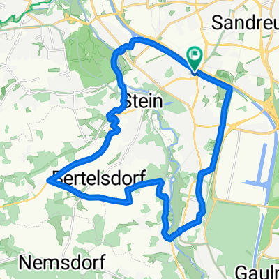
Forstersweiher - Steinbrüchlein
A cycling route starting in Stein, Bavaria, Germany.
Overview
About this route
Radwege auf Straßen mit geringer Steigung
- -:--
- Duration
- 8.5 km
- Distance
- 58 m
- Ascent
- 15 m
- Descent
- ---
- Avg. speed
- 354 m
- Max. altitude
Route quality
Waytypes & surfaces along the route
Waytypes
Quiet road
5.8 km
(68 %)
Path
2.1 km
(25 %)
Surfaces
Paved
8.1 km
(95 %)
Unpaved
0 km
(<1 %)
Asphalt
7.8 km
(93 %)
Paving stones
0.1 km
(1 %)
Continue with Bikemap
Use, edit, or download this cycling route
You would like to ride Forstersweiher - Steinbrüchlein or customize it for your own trip? Here is what you can do with this Bikemap route:
Free features
- Save this route as favorite or in collections
- Copy & plan your own version of this route
- Sync your route with Garmin or Wahoo
Premium features
Free trial for 3 days, or one-time payment. More about Bikemap Premium.
- Navigate this route on iOS & Android
- Export a GPX / KML file of this route
- Create your custom printout (try it for free)
- Download this route for offline navigation
Discover more Premium features.
Get Bikemap PremiumFrom our community
Other popular routes starting in Stein
 Stations-Tour 2021
- Distance
- 44.7 km
- Ascent
- 270 m
- Descent
- 265 m
- Location
- Stein, Bavaria, Germany
 Rund um Röthenbach und Stein
- Distance
- 21.5 km
- Ascent
- 141 m
- Descent
- 141 m
- Location
- Stein, Bavaria, Germany
 Tour mit Jan
- Distance
- 68.5 km
- Ascent
- 367 m
- Descent
- 369 m
- Location
- Stein, Bavaria, Germany
 Am Alten Kanal von Nbg bis Neumarkt id OPf. und zurück
- Distance
- 78.8 km
- Ascent
- 421 m
- Descent
- 390 m
- Location
- Stein, Bavaria, Germany
 nbgHafen_alteKanal_Berching_neuerKanal_2014
- Distance
- 115.5 km
- Ascent
- 257 m
- Descent
- 258 m
- Location
- Stein, Bavaria, Germany
 Panoramatour mit Pepp
- Distance
- 23 km
- Ascent
- 177 m
- Descent
- 177 m
- Location
- Stein, Bavaria, Germany
 Stein-Rudelsdorf-Veitsaurach-Stein
- Distance
- 57.8 km
- Ascent
- 547 m
- Descent
- 498 m
- Location
- Stein, Bavaria, Germany
 NBG Hafen_Berching alter und neuer Kanal
- Distance
- 116.6 km
- Ascent
- 375 m
- Descent
- 351 m
- Location
- Stein, Bavaria, Germany
Open it in the app