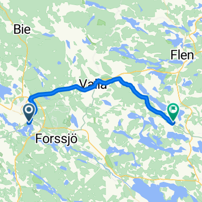
ride through Katrineholm
- 24.5 km
- 142 m
- 142 m
- Katrineholm, Södermanland County, Sweden
A cycling route starting in Katrineholm, Södermanland County, Sweden.
Overview
created this 14 years ago
Route quality
Road
28.7 km
(58 %)
Quiet road
15.8 km
(32 %)
Paved
36.6 km
(74 %)
Unpaved
12.8 km
(26 %)
Asphalt
36.6 km
(74 %)
Gravel
9.4 km
(19 %)
Unpaved (undefined)
3.5 km
(7 %)
Continue with Bikemap
You would like to ride Gota Kanal 3a tappa: Katrineholm - Vreta or customize it for your own trip? Here is what you can do with this Bikemap route:
Free trial for 3 days, or one-time payment. More about Bikemap Premium.
Discover more Premium features.
Get Bikemap PremiumFrom our community
Open it in the app