

2023_Donau-Ilzradweg
A cycling route starting in Niederalteich, Bavaria, Germany.
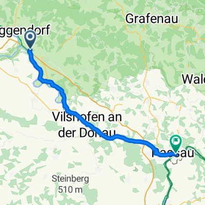
Overview
About this route
- -:--
- Duration
- 52.5 km
- Distance
- 872 m
- Ascent
- 790 m
- Descent
- ---
- Avg. speed
- 506 m
- Max. altitude

Route quality
Waytypes & surfaces along the route
Waytypes
Path
26.8 km
(51 %)
Quiet road
14.7 km
(28 %)
Surfaces
Paved
44.1 km
(84 %)
Unpaved
0.5 km
(1 %)
Asphalt
41.5 km
(79 %)
Paved (undefined)
2.6 km
(5 %)
Continue with Bikemap
Use, edit, or download this cycling route
You would like to ride 2023_Donau-Ilzradweg or customize it for your own trip? Here is what you can do with this Bikemap route:
Free features
- Save this route as favorite or in collections
- Copy & plan your own version of this route
- Sync your route with Garmin or Wahoo
Premium features
Free trial for 3 days, or one-time payment. More about Bikemap Premium.
- Navigate this route on iOS & Android
- Export a GPX / KML file of this route
- Create your custom printout (try it for free)
- Download this route for offline navigation
Discover more Premium features.
Get Bikemap PremiumFrom our community
Other popular routes starting in Niederalteich
 Plattling über Nideralteich
- Distance
- 24.2 km
- Ascent
- 77 m
- Descent
- 71 m
- Location
- Niederalteich, Bavaria, Germany
 2023_Donau-Ilzradweg
- Distance
- 52.5 km
- Ascent
- 872 m
- Descent
- 790 m
- Location
- Niederalteich, Bavaria, Germany
 Niederalteich-Poppenberg-Ohetal-Niederalteich
- Distance
- 51.8 km
- Ascent
- 374 m
- Descent
- 377 m
- Location
- Niederalteich, Bavaria, Germany
 MTB Tour Donautal CLONED FROM ROUTE 1018981
- Distance
- 43.1 km
- Ascent
- 152 m
- Descent
- 152 m
- Location
- Niederalteich, Bavaria, Germany
 Schwarzacher Straße nach Bräugasse
- Distance
- 52.7 km
- Ascent
- 133 m
- Descent
- 142 m
- Location
- Niederalteich, Bavaria, Germany
 2012 Niederaltteich-Wörth/Donau
- Distance
- 71.7 km
- Ascent
- 98 m
- Descent
- 87 m
- Location
- Niederalteich, Bavaria, Germany
 Niederaltteicher Bayerwald-Schaukel
- Distance
- 104.3 km
- Ascent
- 1,672 m
- Descent
- 1,674 m
- Location
- Niederalteich, Bavaria, Germany
 Niederalteich-Ulrichsberg-Regen-Bodenmais-Brennes-Niederalteich
- Distance
- 146.3 km
- Ascent
- 1,612 m
- Descent
- 1,614 m
- Location
- Niederalteich, Bavaria, Germany
Open it in the app