

Ruta Extrema Tecoman-Alcuzahue 2011
A cycling route starting in Tecomán, Colima, Mexico.
Overview
About this route
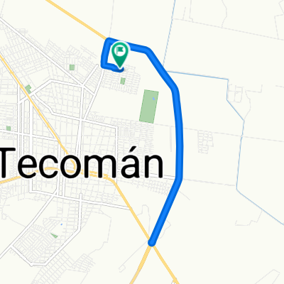
This was the route of the Ruta Extrema Tecoman-Alcuzahue in 2011. It includes the wrong turn I made shortly before finishing upon reaching Tecomán. If you download this route to upload to your GPS, keep that in mind.
- -:--
- Duration
- 72.9 km
- Distance
- 423 m
- Ascent
- 425 m
- Descent
- ---
- Avg. speed
- ---
- Max. altitude

Continue with Bikemap
Use, edit, or download this cycling route
You would like to ride Ruta Extrema Tecoman-Alcuzahue 2011 or customize it for your own trip? Here is what you can do with this Bikemap route:
Free features
- Save this route as favorite or in collections
- Copy & plan your own version of this route
- Sync your route with Garmin or Wahoo
Premium features
Free trial for 3 days, or one-time payment. More about Bikemap Premium.
- Navigate this route on iOS & Android
- Export a GPX / KML file of this route
- Create your custom printout (try it for free)
- Download this route for offline navigation
Discover more Premium features.
Get Bikemap PremiumFrom our community
Other popular routes starting in Tecomán
 De Carretera Tecomán - Boca de Pascuales, Tecomán a Calle Federico Gudiño 10, Tecomán
- Distance
- 20.2 km
- Ascent
- 19 m
- Descent
- 17 m
- Location
- Tecomán, Colima, Mexico
 De Calle Bosque Real a Calle Bosque Real
- Distance
- 12 km
- Ascent
- 53 m
- Descent
- 34 m
- Location
- Tecomán, Colima, Mexico
 20140412_Tecoman_Manzanillo
- Distance
- 61.5 km
- Ascent
- 186 m
- Descent
- 208 m
- Location
- Tecomán, Colima, Mexico
 De Calle Margaritas Norte 216, Tecomán a Venustiano Carranza 325, Tecomán
- Distance
- 2.9 km
- Ascent
- 0 m
- Descent
- 0 m
- Location
- Tecomán, Colima, Mexico
 J58 – Mardi 08 mars 2016 – Tecoman – Colima
- Distance
- 47.6 km
- Ascent
- 636 m
- Descent
- 188 m
- Location
- Tecomán, Colima, Mexico
 De Calle Bosque Real a Calle Bosque Real
- Distance
- 21.7 km
- Ascent
- 85 m
- Descent
- 63 m
- Location
- Tecomán, Colima, Mexico
 Stage 2 2017 Tecoman/Colima
- Distance
- 91.4 km
- Ascent
- 891 m
- Descent
- 449 m
- Location
- Tecomán, Colima, Mexico
 Mascota to Tuxpan
- Distance
- 156.9 km
- Ascent
- 4,298 m
- Descent
- 307 m
- Location
- Tecomán, Colima, Mexico
Open it in the app