

droga z Ottobeuren do Markdorf
A cycling route starting in Ottobeuren, Bavaria, Germany.
Overview
About this route
the route from the campsite in Ottobeuren to Naturcampingplatz Markdorf http://www.wildnis-club.de/Home
- -:--
- Duration
- 99.5 km
- Distance
- 1,023 m
- Ascent
- 1,182 m
- Descent
- ---
- Avg. speed
- 764 m
- Max. altitude

Route quality
Waytypes & surfaces along the route
Waytypes
Quiet road
25.9 km
(26 %)
Road
21.9 km
(22 %)
Surfaces
Paved
82.6 km
(83 %)
Unpaved
1 km
(1 %)
Asphalt
79.6 km
(80 %)
Paved (undefined)
3 km
(3 %)
Continue with Bikemap
Use, edit, or download this cycling route
You would like to ride droga z Ottobeuren do Markdorf or customize it for your own trip? Here is what you can do with this Bikemap route:
Free features
- Save this route as favorite or in collections
- Copy & plan your own version of this route
- Split it into stages to create a multi-day tour
- Sync your route with Garmin or Wahoo
Premium features
Free trial for 3 days, or one-time payment. More about Bikemap Premium.
- Navigate this route on iOS & Android
- Export a GPX / KML file of this route
- Create your custom printout (try it for free)
- Download this route for offline navigation
Discover more Premium features.
Get Bikemap PremiumFrom our community
Other popular routes starting in Ottobeuren
 D03 Allgäu-Runde
- Distance
- 438.1 km
- Ascent
- 4,639 m
- Descent
- 4,641 m
- Location
- Ottobeuren, Bavaria, Germany
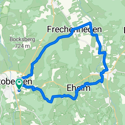
 Unterallgäuer Natur-Tour
- Distance
- 22.5 km
- Ascent
- 200 m
- Descent
- 200 m
- Location
- Ottobeuren, Bavaria, Germany
 B/D Ottobeuren - Westerheim
- Distance
- 8.4 km
- Ascent
- 106 m
- Descent
- 142 m
- Location
- Ottobeuren, Bavaria, Germany
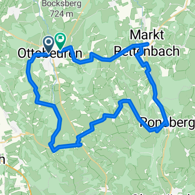 Ottobeuren Süd
- Distance
- 49.1 km
- Ascent
- 812 m
- Descent
- 811 m
- Location
- Ottobeuren, Bavaria, Germany
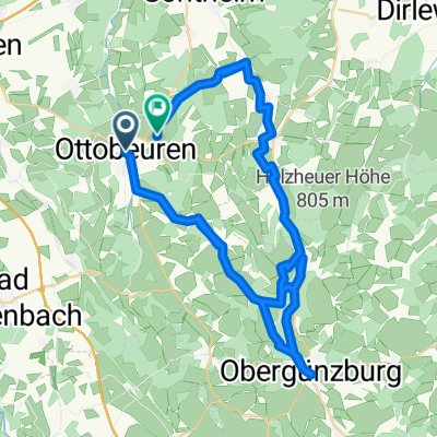
 Ottobeuren West
- Distance
- 40.5 km
- Ascent
- 420 m
- Descent
- 395 m
- Location
- Ottobeuren, Bavaria, Germany
 Markt Rettenbach, Tretanlage
- Distance
- 23.2 km
- Ascent
- 320 m
- Descent
- 321 m
- Location
- Ottobeuren, Bavaria, Germany
 2013-08-15 Radrunde Allgäu
- Distance
- 447.5 km
- Ascent
- 1,472 m
- Descent
- 1,472 m
- Location
- Ottobeuren, Bavaria, Germany
 Ottobeuren Südost
- Distance
- 57 km
- Ascent
- 787 m
- Descent
- 737 m
- Location
- Ottobeuren, Bavaria, Germany
Open it in the app