

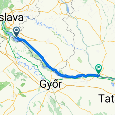
ČUNOVO - OSTRIHOM _1.etapa Čunovo - Ňarád
A cycling route starting in Šamorín, Trnava Region, Slovakia.
Overview
About this route
- -:--
- Duration
- 47.1 km
- Distance
- 76 m
- Ascent
- 91 m
- Descent
- ---
- Avg. speed
- 132 m
- Max. altitude
Route quality
Waytypes & surfaces along the route
Waytypes
Access road
17.5 km
(37 %)
Cycleway
16.2 km
(34 %)
Surfaces
Paved
42.5 km
(90 %)
Asphalt
40.7 km
(86 %)
Paving stones
1.8 km
(4 %)
Undefined
4.6 km
(10 %)
Route highlights
Points of interest along the route
Point of interest after 16.8 km
https://www.google.com/maps/place/Re%C5%A1taur%C3%A1cia+Hal%C3%A1sztanya/@47.9711406,17.349583,13z/data=!4m14!1m7!3m6!1s0x476b81bb35ac9e95:0x744bd129ff965e30!2zUmXFoXRhdXLDoWNpYSBIYWzDoXN6dGFueWE!8m2!3d47.9533385!4d17.4200705!16s%2Fg%2F11t26c3xs_!3m5!1s0x476b81bb35ac9e95:0x744bd129ff965e30!8m2!3d47.9533385!4d17.4200705!16s%2Fg%2F11t26c3xs_?authuser=0&entry=ttu
Accommodation after 45.4 km
https://www.google.com/maps/place/Penzi%C3%B3n+PLATAN/@47.8389797,17.6019973,3a,75y,90t/data=!3m8!1e2!3m6!1sAF1QipOlTsVxUFRCXoBzg5aZ2-18lzxcv4ypAtOkGlew!2e10!3e12!6shttps:%2F%2Flh5.googleusercontent.com%2Fp%2FAF1QipOlTsVxUFRCXoBzg5aZ2-18lzxcv4ypAtOkGlew%3Dw203-h152-k-no!7i4000!8i3000!4m10!3m9!1s0x476b97563b39eebb:0x2bd0e0fd090be955!5m2!4m1!1i2!8m2!3d47.8388986!4d17.6018572!10e5!16s%2Fg%2F1v1vb_4r?authuser=0&entry=ttu
Continue with Bikemap
Use, edit, or download this cycling route
You would like to ride ČUNOVO - OSTRIHOM _1.etapa Čunovo - Ňarád or customize it for your own trip? Here is what you can do with this Bikemap route:
Free features
- Save this route as favorite or in collections
- Copy & plan your own version of this route
- Sync your route with Garmin or Wahoo
Premium features
Free trial for 3 days, or one-time payment. More about Bikemap Premium.
- Navigate this route on iOS & Android
- Export a GPX / KML file of this route
- Create your custom printout (try it for free)
- Download this route for offline navigation
Discover more Premium features.
Get Bikemap PremiumFrom our community
Other popular routes starting in Šamorín
 Kyselica - Gabčíkovo a späť
- Distance
- 53.7 km
- Ascent
- 72 m
- Descent
- 72 m
- Location
- Šamorín, Trnava Region, Slovakia
 najvacsi chill-smrt
- Distance
- 58.9 km
- Ascent
- 45 m
- Descent
- 48 m
- Location
- Šamorín, Trnava Region, Slovakia
 Čilistov X-BIONIC SPHERE-Kyselica-Horný Bar-Gabčíkovo-Čilistov X-BIONIC SPHERE
- Distance
- 50.8 km
- Ascent
- 33 m
- Descent
- 33 m
- Location
- Šamorín, Trnava Region, Slovakia
 Burgenland
- Distance
- 225.1 km
- Ascent
- 268 m
- Descent
- 270 m
- Location
- Šamorín, Trnava Region, Slovakia
 a Duna víztározó körül 2015.04.19.
- Distance
- 100 km
- Ascent
- 61 m
- Descent
- 61 m
- Location
- Šamorín, Trnava Region, Slovakia
 Day 2 - Šamorín - Komárno
- Distance
- 80.4 km
- Ascent
- 75 m
- Descent
- 88 m
- Location
- Šamorín, Trnava Region, Slovakia
 2. Čuňovo - Köszek_112km
- Distance
- 111.7 km
- Ascent
- 231 m
- Descent
- 89 m
- Location
- Šamorín, Trnava Region, Slovakia
 R: Okolo Hrušovskej zdrže a cez kompu (Kyselica - Prístavný most)
- Distance
- 62.6 km
- Ascent
- 29 m
- Descent
- 26 m
- Location
- Šamorín, Trnava Region, Slovakia
Open it in the app