

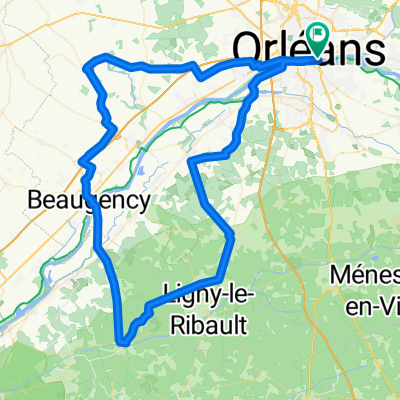
loiret - SO - 81kms
A cycling route starting in Saint-Jean-le-Blanc, Centre-Val de Loire, France.
Overview
About this route
Orleans - levee - Melleray - St Cyr - Ardon - route de Mézières - Jouy - (pause route de Dry km38.5) - Monçay - Lailly - direction Beaugency - Dry - return via levee
- -:--
- Duration
- 81.2 km
- Distance
- 217 m
- Ascent
- 217 m
- Descent
- ---
- Avg. speed
- 118 m
- Max. altitude

Route photos


Route quality
Waytypes & surfaces along the route
Waytypes
Quiet road
36.6 km
(45 %)
Road
11.4 km
(14 %)
Surfaces
Paved
34.1 km
(42 %)
Asphalt
31.7 km
(39 %)
Paved (undefined)
1.6 km
(2 %)
Route highlights
Points of interest along the route
Drinking water after 37 km
Pause rte de Dry km38,5
Continue with Bikemap
Use, edit, or download this cycling route
You would like to ride loiret - SO - 81kms or customize it for your own trip? Here is what you can do with this Bikemap route:
Free features
- Save this route as favorite or in collections
- Copy & plan your own version of this route
- Split it into stages to create a multi-day tour
- Sync your route with Garmin or Wahoo
Premium features
Free trial for 3 days, or one-time payment. More about Bikemap Premium.
- Navigate this route on iOS & Android
- Export a GPX / KML file of this route
- Create your custom printout (try it for free)
- Download this route for offline navigation
Discover more Premium features.
Get Bikemap PremiumFrom our community
Other popular routes starting in Saint-Jean-le-Blanc
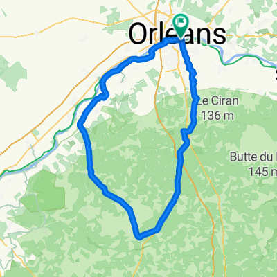
 LOIRET - SO - 92km orleans
- Distance
- 91.6 km
- Ascent
- 226 m
- Descent
- 229 m
- Location
- Saint-Jean-le-Blanc, Centre-Val de Loire, France
 LOIRET - S - 96KM - st privé-dry-moncay-lailly-huisseau-chaingy
- Distance
- 95.4 km
- Ascent
- 298 m
- Descent
- 297 m
- Location
- Saint-Jean-le-Blanc, Centre-Val de Loire, France
 LOIRET Nord - 117kms - Phithiviers le Viel
- Distance
- 116.9 km
- Ascent
- 453 m
- Descent
- 453 m
- Location
- Saint-Jean-le-Blanc, Centre-Val de Loire, France
 LOIRET NE - 111 KMS - étang de la vallée- chambon
- Distance
- 111.5 km
- Ascent
- 157 m
- Descent
- 157 m
- Location
- Saint-Jean-le-Blanc, Centre-Val de Loire, France
 LOIRET Ouest orleans, marchenoir 112km
- Distance
- 113.6 km
- Ascent
- 648 m
- Descent
- 648 m
- Location
- Saint-Jean-le-Blanc, Centre-Val de Loire, France
 LOIRET -SO - 103KM
- Distance
- 103.1 km
- Ascent
- 280 m
- Descent
- 278 m
- Location
- Saint-Jean-le-Blanc, Centre-Val de Loire, France
 LOIRET - SUD - 109km
- Distance
- 109.1 km
- Ascent
- 332 m
- Descent
- 328 m
- Location
- Saint-Jean-le-Blanc, Centre-Val de Loire, France
 LOIRET - SO - 82km orleans
- Distance
- 80.7 km
- Ascent
- 189 m
- Descent
- 192 m
- Location
- Saint-Jean-le-Blanc, Centre-Val de Loire, France
Open it in the app