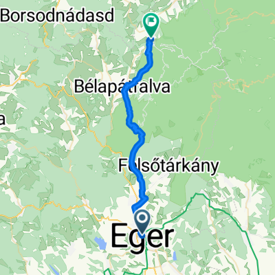
Történelmi Belváros, Eger - Fenyves utca, Szilvásvárad
- 30 km
- 776 m
- 596 m
- Eger, Heves County, Hungary
A cycling route starting in Eger, Heves County, Hungary.
Overview
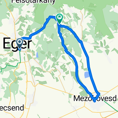
Bike Tour from Eger to Felsőtárkány (Eger – Felsőtárkány – Eger)
Distance: approx. 25 km, elevation gain: 300 m Duration: 3-4 hours
From downtown Eger, passing through Markhót Ferenc, Servita, and Vécsey Sándor streets, we reach the Castle Station. From here, we follow the Blue cycling route sign to leave the city. Our route leads through gardens and vineyards around Eger to the foot of Eged Hill, initially on asphalt, then on dirt road. At first, the ascent is gentler, then becomes steeper upon reaching the forest edge, taking us up the side of Kis-Tiba Hill. Continuing along the Blue cycling route, the road mostly descends all the way to Felsőtárkány. At the Várhegy residential area, we reach the village and soon the developed bike path. From here, following the Red cycling route to the right (uphill), we can ride on the bike path all the way to the Bükk National Park Visitor Centre and the adjacent lake. For a rest, it is worth visiting the 'Karst and Its Wildlife' exhibition at the Western Gate Educational and Visitor Centre of the Bükk National Park Directorate and relaxing by the lakeside.
From the lakeside, we bike back to Eger. First, we ride on the main road, then at the village end, we turn onto the bike path and follow the Red cycling route back to Eger. In the city, following the signs, we return to the rental through the bike path.
created this 13 years ago
Route quality
Cycleway
7.6 km
(30 %)
Track
6.6 km
(26 %)
Paved
12.4 km
(49 %)
Unpaved
1 km
(4 %)
Asphalt
12.4 km
(49 %)
Ground
1 km
(4 %)
Undefined
11.9 km
(47 %)
Continue with Bikemap
You would like to ride Körtúra Egerből Felsőtárkányba or customize it for your own trip? Here is what you can do with this Bikemap route:
Free trial for 3 days, or one-time payment. More about Bikemap Premium.
Discover more Premium features.
Get Bikemap PremiumFrom our community
Open it in the app