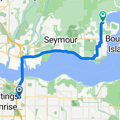
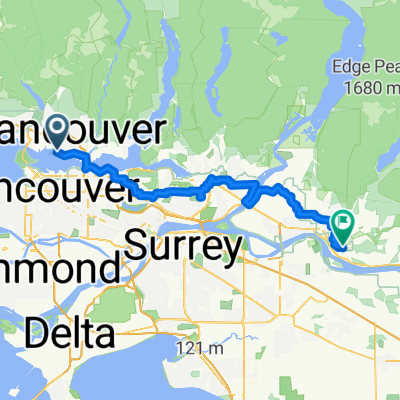
Central Lonsdale - Circle to Stanley Park
A cycling route starting in North Vancouver, British Columbia, Canada.
Overview
About this route
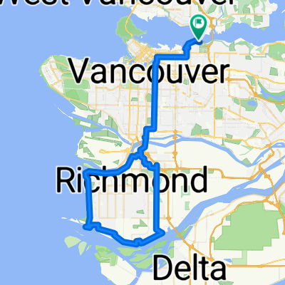
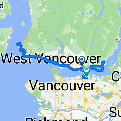
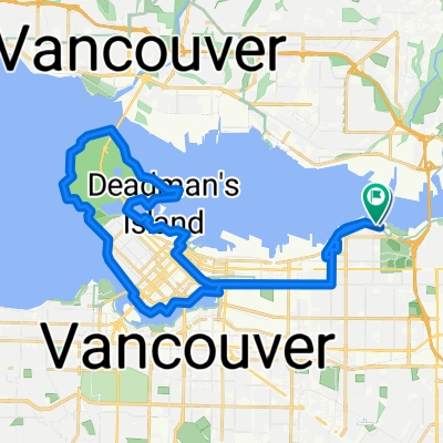
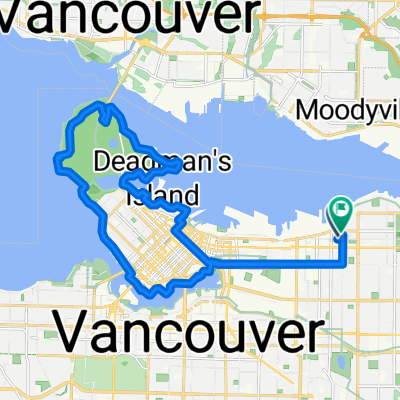
Today’s riding through parts of North Vancouver and over the Lions Gate Bridge into Stanley Park again emphasized what a wonderful job the locality has done in creating great bicycle infrastructure. We’ve now been across three bridges, each with excellent paths for pedestrians and cyclists. Stanley Park had excellent cycling road and paths for those who want to push it and for those who just able along. With the wonderful weather today, there were plenty of people out, which made us stay primarily on the park roads rather than the cycling paths.
- 4 h 14 min
- Duration
- 31.1 km
- Distance
- 627 m
- Ascent
- 622 m
- Descent
- 7.3 km/h
- Avg. speed
- 128 m
- Avg. speed
Route photos
Route quality
Waytypes & surfaces along the route
Waytypes
Undefined
31.1 km
(100 %)
Surfaces
Undefined
31.1 km
(100 %)
Continue with Bikemap
Use, edit, or download this cycling route
You would like to ride Central Lonsdale - Circle to Stanley Park or customize it for your own trip? Here is what you can do with this Bikemap route:
Free features
- Save this route as favorite or in collections
- Copy & plan your own version of this route
- Sync your route with Garmin or Wahoo
Premium features
Free trial for 3 days, or one-time payment. More about Bikemap Premium.
- Navigate this route on iOS & Android
- Export a GPX / KML file of this route
- Create your custom printout (try it for free)
- Download this route for offline navigation
Discover more Premium features.
Get Bikemap PremiumFrom our community
Other popular routes starting in North Vancouver
- Mosquito Creek to Silva Bay, Gabriola Is., BC
- Distance
- 49.4 km
- Ascent
- 0 m
- Descent
- 0 m
- Location
- North Vancouver, British Columbia, Canada
- 2055 Old Dollarton Rd, North Vancouver to 1195 Redwood St, North Vancouver
- Distance
- 9.7 km
- Ascent
- 182 m
- Descent
- 188 m
- Location
- North Vancouver, British Columbia, Canada
- North Vancouver to Mission
- Distance
- 79.9 km
- Ascent
- 1,057 m
- Descent
- 1,071 m
- Location
- North Vancouver, British Columbia, Canada
- Bowen Island Bounder
- Distance
- 52.6 km
- Ascent
- 412 m
- Descent
- 412 m
- Location
- North Vancouver, British Columbia, Canada
- Central Lonsdale - Circle to Stanley Park
- Distance
- 31.1 km
- Ascent
- 627 m
- Descent
- 622 m
- Location
- North Vancouver, British Columbia, Canada
- Studio to Buntzen Lake
- Distance
- 89.3 km
- Ascent
- 877 m
- Descent
- 879 m
- Location
- North Vancouver, British Columbia, Canada
- 3518 Napier St, Vancouver to 3518 Napier St, Vancouver
- Distance
- 43 km
- Ascent
- 861 m
- Descent
- 864 m
- Location
- North Vancouver, British Columbia, Canada
- 100km Poco
- Distance
- 104.8 km
- Ascent
- 289 m
- Descent
- 289 m
- Location
- North Vancouver, British Columbia, Canada