![명륜2가 125-2Ph0]으로 라우팅](/_next/static/media/contour-lines-light-small.cafd5e5d.avif)
![명륜2가 125-2Ph0]으로 라우팅](https://media.bikemap.net/routes/14650463/staticmaps/in_71054694-ecc0-40e3-8213-7d6512d17888_694x400_bikemap-2021-3D-static.png)
명륜2가 125-2Ph0]으로 라우팅
A cycling route starting in Seoul, Seoul, Republic of Korea.
Overview
About this route
- 37 h 17 min
- Duration
- 70.9 km
- Distance
- 1,522 m
- Ascent
- 1,581 m
- Descent
- 1.9 km/h
- Avg. speed
- 293 m
- Avg. speed

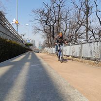
Route photos
![Photo 1 of the Bikemap route "명륜2가 125-2Ph0]으로 라우팅"](https://media.bikemap.net/routes/14650463/gallery/thumbs/94673db0-bb2e-4818-a872-aa2a1241d2ca.jpg.688x400_q80_crop.jpg "Photo 1 of the Bikemap route \"명륜2가 125-2Ph0]으로 라우팅\"")
![Photo 2 of the Bikemap route "명륜2가 125-2Ph0]으로 라우팅"](https://media.bikemap.net/routes/14650463/gallery/thumbs/8b507931-298e-4b41-8b8e-c2a42b6343b4.jpg.688x400_q80_crop.jpg "Photo 2 of the Bikemap route \"명륜2가 125-2Ph0]으로 라우팅\"")
Route quality
Waytypes & surfaces along the route
Waytypes
Road
29.5 km
(42 %)
Quiet road
21.5 km
(30 %)
Surfaces
Paved
14.9 km
(21 %)
Unpaved
1.3 km
(2 %)
Asphalt
14.9 km
(21 %)
Ground
1.3 km
(2 %)
Undefined
54.7 km
(77 %)
Continue with Bikemap
Use, edit, or download this cycling route
You would like to ride 명륜2가 125-2Ph0]으로 라우팅 or customize it for your own trip? Here is what you can do with this Bikemap route:
Free features
- Save this route as favorite or in collections
- Copy & plan your own version of this route
- Sync your route with Garmin or Wahoo
Premium features
Free trial for 3 days, or one-time payment. More about Bikemap Premium.
- Navigate this route on iOS & Android
- Export a GPX / KML file of this route
- Create your custom printout (try it for free)
- Download this route for offline navigation
Discover more Premium features.
Get Bikemap PremiumFrom our community
Other popular routes starting in Seoul
 Radtour Korea Oktober 2012
- Distance
- 801.5 km
- Ascent
- 3,285 m
- Descent
- 3,252 m
- Location
- Seoul, Seoul, Republic of Korea
 test
test- Distance
- 39.4 km
- Ascent
- 439 m
- Descent
- 439 m
- Location
- Seoul, Seoul, Republic of Korea
 Route from Mapo-dong 36-2
- Distance
- 35.6 km
- Ascent
- 154 m
- Descent
- 167 m
- Location
- Seoul, Seoul, Republic of Korea
 잠수교 남단출발 집
- Distance
- 13.4 km
- Ascent
- 124 m
- Descent
- 137 m
- Location
- Seoul, Seoul, Republic of Korea
 여의도-반포-잠실 한강 라이딩 코스
- Distance
- 16.7 km
- Ascent
- 223 m
- Descent
- 224 m
- Location
- Seoul, Seoul, Republic of Korea
 Seoul to Guri City
- Distance
- 30.7 km
- Ascent
- 251 m
- Descent
- 244 m
- Location
- Seoul, Seoul, Republic of Korea
![명륜2가 125-2Ph0]으로 라우팅](https://media.bikemap.net/routes/14650463/gallery/thumbs/94673db0-bb2e-4818-a872-aa2a1241d2ca.jpg.208x208_q80_crop.jpg) 명륜2가 125-2Ph0]으로 라우팅
명륜2가 125-2Ph0]으로 라우팅- Distance
- 70.9 km
- Ascent
- 1,522 m
- Descent
- 1,581 m
- Location
- Seoul, Seoul, Republic of Korea
 Seoul-Busan V2013
- Distance
- 435.8 km
- Ascent
- 1,043 m
- Descent
- 1,036 m
- Location
- Seoul, Seoul, Republic of Korea
Open it in the app