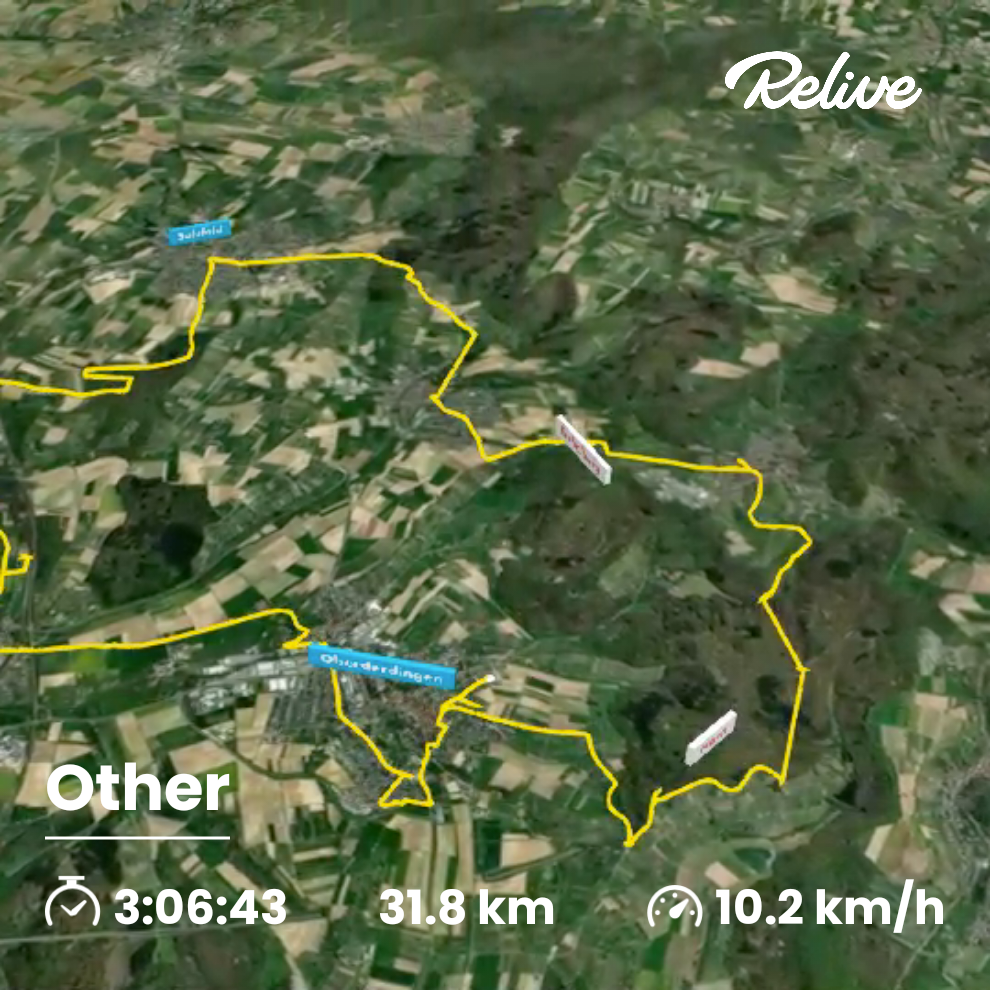
SulzfeldRunde
- 14.7 km
- 117 m
- 117 m
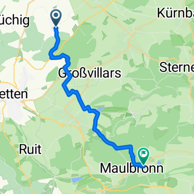
- Oberderdingen, Baden-Wurttemberg, Germany
A cycling route starting in Oberderdingen, Baden-Wurttemberg, Germany.
Overview
Flehingen – Rohrbach 15.5 km
The tour starts at the train station in Flehingen. Head downhill on ‚Bahnhofstraße‘ into the village. At the main road, continue straight onto ‚Gochsheimer Straße‘, passing the castle and leaving the village.
Follow the paved agricultural road along the Kraichbach to Gochsheim.
There, on the main road, turn left and then the next right uphill on the paved agricultural road into the village. Continue straight onto ‚Bertold Bott Straße‘, and at the fork with ‚Görnstraße‘ turn right to the main road.
Turn left there and the next right onto the road closed to cars on weekends. Follow the road through the valley along the railway tracks.
At the stop, turn right to the main road and then left on the cycle path. At the end of the cycle path, continue straight to and past the former mill.
Follow the gravel road around the right curve and at the next fork continue straight to Rohrbach.
At the end of the gravel road, turn left, then right, and again left now on asphalt further along the valley following the Eschbach. At the entrance to Landshausen near the sports field, turn left, then the next right and at the following fork slightly left and gently uphill.
Continue straight over the ridge and follow the paved path downhill into the valley. There turn right, cross the bridge, then left around the curve and past the sports field straight into Rohrbach.
Rohrbach / Flehingen 16.5 km
At the T-junction turn right and continue straight along ‚Gochsheimer Straße‘ out of the village.
At the farm continue straight over the hill and again at the next farm straight over the hill to the B293.
Cross this straight and follow the L593 to Sulzfeld. After about 300 m a paved agricultural road begins on the right parallel to the main road.
It descends steeply along the vineyard. In the valley, turn right at the junction, then right towards the village centre. After about 100 m turn right onto the agricultural road that runs along the road to Zaisenhausen.
At the entrance to Zaisenhausen, half left into the 30 km/h zone. At the 4-way junction turn left towards the cemetery through the underpass.
Continue straight past the cemetery and uphill into the forest. At the fork in the forest go straight downhill and at the fork towards the Heiligenäcker settlement continue straight to Kürnbach.
After the industrial area continue straight across the main road, past the sports field, then right and through the village centre.
After the market square turn left to the main road and cross it straight. Turn right into ‚Derdinger Straße‘ and follow it straight out of the village. Cross the L593 straight and continue straight on the agricultural road in the valley.
Follow the paved road uphill to the left and at the top turn right towards Flehingen. Cross the bridge straight into the village. Downhill over the railway and the next left into ‚Bahnhofstraße‘ and back to the starting point.
created this 13 years ago
Route quality
Track
17.6 km
(55 %)
Quiet road
10.9 km
(34 %)
Paved
25 km
(78 %)
Unpaved
2.2 km
(7 %)
Asphalt
13.1 km
(41 %)
Paved (undefined)
10.2 km
(32 %)
Continue with Bikemap
You would like to ride Ähren-Tour or customize it for your own trip? Here is what you can do with this Bikemap route:
Free trial for 3 days, or one-time payment. More about Bikemap Premium.
Discover more Premium features.
Get Bikemap PremiumFrom our community
Open it in the app