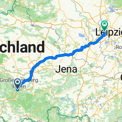
Rennsteiggarten-Zella-Mehlis-Suhl-Ilmenau
- 67.1 km
- 1,214 m
- 1,215 m
- Oberhof, Thuringia, Germany
A cycling route starting in Oberhof, Thuringia, Germany.
Overview
Großer Beerberg (942 m)
Ringbergpass (837 m)
created this 13 years ago
Route highlights
Großer Beerberg (942 m) Der Große Beerberg ist mit 983 m der höchste Berg des Thüringer Waldes. Der höchste Punkt der Straße wird durch ein Schild „942 m ü.NN” markiert und muss uns Rennradfahrern als Zielankunft genügen.
Kreuzung Rennsteig (758 m)
Ringbergpass (837 m)
Continue with Bikemap
You would like to ride Oberhof nach Fladungen Christian or customize it for your own trip? Here is what you can do with this Bikemap route:
Free trial for 3 days, or one-time payment. More about Bikemap Premium.
Discover more Premium features.
Get Bikemap PremiumFrom our community
Open it in the app