From Saint-Junien to Bourdeilles
- 89.8 km
- 1,294 m
- 1,434 m
- Saint-Junien, Nouvelle-Aquitaine, France
A cycling route starting in Saint-Junien, Nouvelle-Aquitaine, France.
Overview
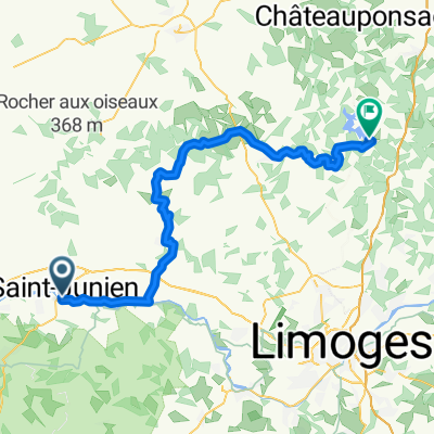
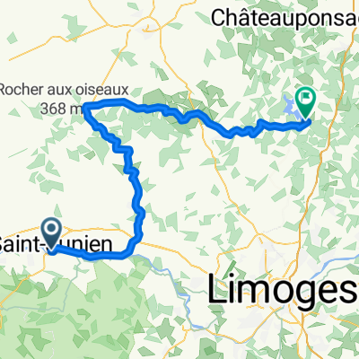
Ride Day 2
—21 June 2009—87200 Saint-Julien to 87400 Saint-Léonard-de-Noblat
Another beautiful day with great weather and outstanding roads. Pretty much all roads after leaving the A20 were perfect low traffic country roads. Today the climbing was often steeper and nothing (save the short time on the A20) was flat.
Our route took us through Oradour-sur-Glane which has particular historical importance from WWII. The entire ride was within Haute-Vienne.
Background:
My wife and I have been doing self-supported tours in Western Europe (a majority in France) since 1993. This series of rides covers our 2009 4.5 month route through parts of France, Germany, Austria, Switzerland, and then back to France. Our beginning and ending point is near Chadurie (south of Angoulême) where our friends have a farm with Gites and Chambres d'Hotes.
We rode our Dawes touring bicycles purchased in 1993 heavily loaded with 700Cx32 tires. All of our riding was on paved roads, mostly with very little traffic. Pretty much the only unpaved sections were some bicycle paths in Germany and Austria. Sadly, that wasn't so great as Helen fell a number of times on the unpaved paths. Fortunately, though, no serious injury.
If any questions, feel free to email me at jeffkadet@netdiving.com
Jeff
created this 13 years ago
Route quality
Road
36.4 km
(57 %)
Quiet road
3.8 km
(6 %)
Paved
18.5 km
(29 %)
Asphalt
18.5 km
(29 %)
Undefined
45.4 km
(71 %)
Continue with Bikemap
You would like to ride 2009 Euro Tour -- Ride Day 2 -- 21 June 2009 -- 87200 Saint-Julien to 87400 Saint-Léonard-de-Noblat or customize it for your own trip? Here is what you can do with this Bikemap route:
Free trial for 3 days, or one-time payment. More about Bikemap Premium.
Discover more Premium features.
Get Bikemap PremiumFrom our community
Open it in the app