

Medina County Road Cycling
A cycling route starting in Brunswick, Ohio, United States.
Overview
About this route
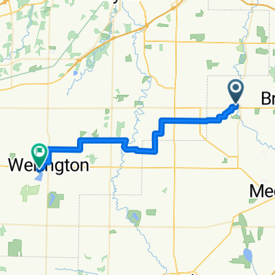
Schaun Acres Campground to Ravenna OH
- 5 h 50 min
- Duration
- 89.1 km
- Distance
- 704 m
- Ascent
- 663 m
- Descent
- 15.3 km/h
- Avg. speed
- 381 m
- Max. altitude

Route photos

Route quality
Waytypes & surfaces along the route
Waytypes
Road
35.6 km
(40 %)
Cycleway
27.6 km
(31 %)
Surfaces
Paved
45.5 km
(51 %)
Asphalt
28.5 km
(32 %)
Paved (undefined)
16 km
(18 %)
Continue with Bikemap
Use, edit, or download this cycling route
You would like to ride Medina County Road Cycling or customize it for your own trip? Here is what you can do with this Bikemap route:
Free features
- Save this route as favorite or in collections
- Copy & plan your own version of this route
- Split it into stages to create a multi-day tour
- Sync your route with Garmin or Wahoo
Premium features
Free trial for 3 days, or one-time payment. More about Bikemap Premium.
- Navigate this route on iOS & Android
- Export a GPX / KML file of this route
- Create your custom printout (try it for free)
- Download this route for offline navigation
Discover more Premium features.
Get Bikemap PremiumFrom our community
Other popular routes starting in Brunswick
 Foxborough Drive 483, Brunswick to Grafton Road 3021, Brunswick
- Distance
- 2.2 km
- Ascent
- 13 m
- Descent
- 13 m
- Location
- Brunswick, Ohio, United States
 valley city to wellington
- Distance
- 36.4 km
- Ascent
- 66 m
- Descent
- 52 m
- Location
- Brunswick, Ohio, United States
 Medina Co_Cuyahoga Valley
- Distance
- 101.8 km
- Ascent
- 605 m
- Descent
- 605 m
- Location
- Brunswick, Ohio, United States
 Grafton Road 3021, Brunswick to Grafton Road 3021, Brunswick
- Distance
- 1 km
- Ascent
- 3 m
- Descent
- 4 m
- Location
- Brunswick, Ohio, United States
 North Canton Tennis Facility
- Distance
- 77.3 km
- Ascent
- 413 m
- Descent
- 349 m
- Location
- Brunswick, Ohio, United States
 Medina County Road Cycling
- Distance
- 89.1 km
- Ascent
- 704 m
- Descent
- 663 m
- Location
- Brunswick, Ohio, United States
 1769 Old Windmill Trail, Valley City to 1769 Old Windmill Trail, Valley City
- Distance
- 55.6 km
- Ascent
- 244 m
- Descent
- 244 m
- Location
- Brunswick, Ohio, United States
 Slow ride in Brunswick
- Distance
- 7.1 km
- Ascent
- 62 m
- Descent
- 43 m
- Location
- Brunswick, Ohio, United States
Open it in the app