La Loubière-Combret - Circle to Lacaune
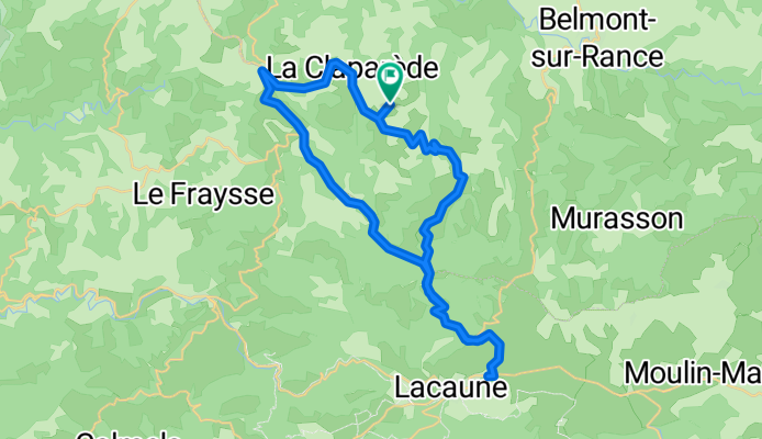
A cycling route starting in Belmont-sur-Rance, Languedoc-Roussillon-Midi-Pyrénées, France.
Overview
About this route
This circle had plenty of steep ups and downs. And the scenery was wonderful.
If you like downhills, the portion of the ride on D554 was one heck of a downhill.
All roads were either low traffic or virtually zero traffic.
As you'll see from the photos, we passed through three cols. They were:
Col de Sié 999M Col de Peyronnenc 879M Col du Capélou 605M
- 4 h 49 min
- Duration
- 42.2 km
- Distance
- 905 m
- Ascent
- 906 m
- Descent
- 8.8 km/h
- Avg. speed
- 995 m
- Avg. speed
Route photos
Route quality
Waytypes & surfaces along the route
Waytypes
Busy road
24.4 km
(58 %)
Road
13.6 km
(32 %)
Continue with Bikemap
Use, edit, or download this cycling route
You would like to ride La Loubière-Combret - Circle to Lacaune or customize it for your own trip? Here is what you can do with this Bikemap route:
Free features
- Save this route as favorite or in collections
- Copy & plan your own version of this route
- Sync your route with Garmin or Wahoo
Premium features
Free trial for 3 days, or one-time payment. More about Bikemap Premium.
- Navigate this route on iOS & Android
- Export a GPX / KML file of this route
- Create your custom printout (try it for free)
- Download this route for offline navigation
Discover more Premium features.
Get Bikemap PremiumFrom our community
Other popular routes starting in Belmont-sur-Rance
- Combret (La Loubière) to Castres
- Distance
- 75.3 km
- Ascent
- 827 m
- Descent
- 1,217 m
- Location
- Belmont-sur-Rance, Languedoc-Roussillon-Midi-Pyrénées, France
- Saint-Sernin/Rance à Bédarieux
- Distance
- 100.6 km
- Ascent
- 1,164 m
- Descent
- 1,298 m
- Location
- Belmont-sur-Rance, Languedoc-Roussillon-Midi-Pyrénées, France
- st sernin bédarrieux par lacaune
- Distance
- 88.2 km
- Ascent
- 818 m
- Descent
- 933 m
- Location
- Belmont-sur-Rance, Languedoc-Roussillon-Midi-Pyrénées, France
- Tappa 8 Belmont sur Rance - Carcassonne
- Distance
- 100.9 km
- Ascent
- 1,705 m
- Descent
- 2,037 m
- Location
- Belmont-sur-Rance, Languedoc-Roussillon-Midi-Pyrénées, France
- La Loubière-Combret - Circle to Lacaune
- Distance
- 42.2 km
- Ascent
- 905 m
- Descent
- 906 m
- Location
- Belmont-sur-Rance, Languedoc-Roussillon-Midi-Pyrénées, France
- De Saint-Sever 181, Saint-Sever-du-Moustier à Saint-Sever 181, Saint-Sever-du-Moustier
- Distance
- 47.4 km
- Ascent
- 1,195 m
- Descent
- 1,198 m
- Location
- Belmont-sur-Rance, Languedoc-Roussillon-Midi-Pyrénées, France
- Saint-Sernin-sur-Rance - Circle through Pousthomy
- Distance
- 20.8 km
- Ascent
- 519 m
- Descent
- 514 m
- Location
- Belmont-sur-Rance, Languedoc-Roussillon-Midi-Pyrénées, France
- etape 3
- Distance
- 88.4 km
- Ascent
- ---
- Descent
- ---
- Location
- Belmont-sur-Rance, Languedoc-Roussillon-Midi-Pyrénées, France
Open it in the app