
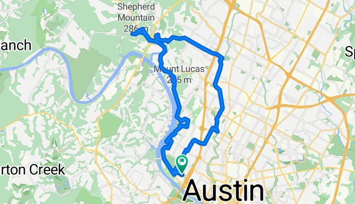
Austin - Circle to Northwest
A cycling route starting in Rollingwood, Texas, United States.
Overview
About this route
This was an interesting ride mostly through a number of neighborhoods. There were some pretty steep ups and downs.
Maybe two or three miles were on FM2222. This road had moderate traffic and little or no shoulder up until hitting North Capital of Texas Highway (360). West of 360, there was a nice wide shoulder.
City Park Road had a bike lane on the uphill side for the time that I was on it. That portion was pretty steep. Although I wanted to ride all the way to the end of this road, which I understand is in Emma Long Metropolitan Park, I had to turn back where I did due to time constraints on my ride.
Far West Blvd was pretty steep initially, but it did have an excellent bike lane on that portion. Also, there was almost no traffic on this portion of the road. After passing east of Mesa Drive, there's more traffic, but an excellent bike lane or a right turn lane to ride in.
Shoal Creek Blvd has excellent bike lanes.
- 2 h 17 min
- Duration
- 33.8 km
- Distance
- 514 m
- Ascent
- 506 m
- Descent
- 14.8 km/h
- Avg. speed
- 274 m
- Max. altitude

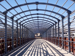
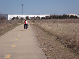
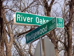
Route photos


Route quality
Waytypes & surfaces along the route
Waytypes
Road
16.4 km
(49 %)
Quiet road
8 km
(24 %)
Surfaces
Paved
28.6 km
(85 %)
Asphalt
27.9 km
(83 %)
Concrete
0.6 km
(2 %)
Continue with Bikemap
Use, edit, or download this cycling route
You would like to ride Austin - Circle to Northwest or customize it for your own trip? Here is what you can do with this Bikemap route:
Free features
- Save this route as favorite or in collections
- Copy & plan your own version of this route
- Sync your route with Garmin or Wahoo
Premium features
Free trial for 3 days, or one-time payment. More about Bikemap Premium.
- Navigate this route on iOS & Android
- Export a GPX / KML file of this route
- Create your custom printout (try it for free)
- Download this route for offline navigation
Discover more Premium features.
Get Bikemap PremiumFrom our community
Other popular routes starting in Rollingwood
 Buda loop - 37 mi
- Distance
- 60.2 km
- Ascent
- 212 m
- Descent
- 213 m
- Location
- Rollingwood, Texas, United States
 Austin - Circle to MT Supermarket and Costco
- Distance
- 50.5 km
- Ascent
- 428 m
- Descent
- 428 m
- Location
- Rollingwood, Texas, United States
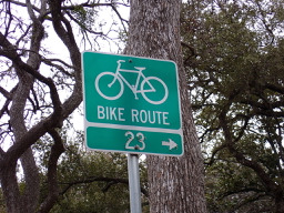 Austin - Circle to North Via Camp Mabry, Bike Rt 23, and Shoal Creek Blvd
- Distance
- 39.5 km
- Ascent
- 515 m
- Descent
- 513 m
- Location
- Rollingwood, Texas, United States
 Austin - Circle thru Lost Creek Blvd to Barton Creek and Costco
- Distance
- 41.4 km
- Ascent
- 572 m
- Descent
- 572 m
- Location
- Rollingwood, Texas, United States
 Austin - Circle Southeast to Richard Moya Park
- Distance
- 47.2 km
- Ascent
- 288 m
- Descent
- 288 m
- Location
- Rollingwood, Texas, United States
 Austin to Giddings
- Distance
- 113.7 km
- Ascent
- 492 m
- Descent
- 529 m
- Location
- Rollingwood, Texas, United States
 Austin - Circle to Bee Cave
- Distance
- 44.6 km
- Ascent
- 562 m
- Descent
- 564 m
- Location
- Rollingwood, Texas, United States
 Austin - Circle to MT Supermarket and Walnut Creek
- Distance
- 49.2 km
- Ascent
- 414 m
- Descent
- 413 m
- Location
- Rollingwood, Texas, United States
Open it in the app