Premium Badge Download on the App Store Get it on Google Play Turn-by-turn Navigation Offline Maps Bike Type Optimized Routing Premium Maps Custom Bike Computer Export Routes Route Previews Fall Detection Premium Support

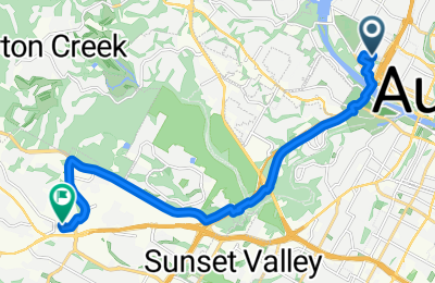
Cycling Route in Rollingwood, Texas, United States of America

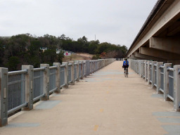
Austin - Mopac Cycling Path - Southwest Parkway - William Cannon Dr.

0
Open this route in the Bikemap app

Open this route in the Bikemap app

Open this route in Bikemap Web

Open this route in Bikemap Web

16 km
Distance
243 m
Ascent
154 m
Descent
1:10 h
Duration
14.0 km/h
Avg. Speed
304 m
Max. Elevation

About This Route

This is a part of a circle from West 9th St. Unfortunately, the bikemap app crashed mid-ride. The missing portion is from along the William Cannon Drive south to Costco, followed by a ride east along the Mopac Cycling Path all the way back into central Austin and the West 9th St. starting point. Overall a nice ride, though there is a lot of noise from the traffic on both Mopac and the Southwest Parkway. Except for a little portion when getting onto Southwest Parkway, there was excellent wide road shoulder all the way to the intersection with William Cannon Dr. From prior riding on the Southwest Parkway, I'm aware that the great shoulder continues until it hits Highway 71.

This cycling route is ideal for: Road bike MTB City bike

Route Photos

Customize this cycling route with the Bikemap route planner.

Make it yours!

Did you know? You can use this route as a template in our cycling route planner if you don't wish to start from scratch. Customize it based on your needs to plan your perfect cycling tour.

Open it in the app