

Austin - Circle thru Lost Creek Blvd to Barton Creek and Costco
A cycling route starting in Rollingwood, Texas, United States.
Overview
About this route
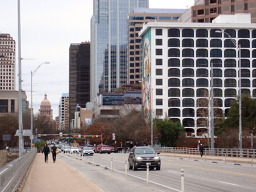
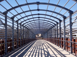
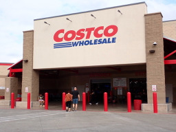
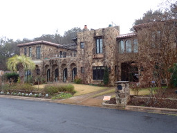
Today’s ride was a great circle to Costco via Lost Creek Rd and Barton Creek using local cycling route 64. There were some seriously steep ups and downs that had me out of the saddle in my lowest gear just trying to remain vertical. Fortunately, none of them were very long, but definitely long enough to be huffing and puffing by the time I’d reached the top. This ride was mostly through neighborhoods aside from the part of the ride that follows the service road and cycling path along Mopac.
- 3 h 7 min
- Duration
- 41.4 km
- Distance
- 572 m
- Ascent
- 572 m
- Descent
- 13.3 km/h
- Avg. speed
- 302 m
- Max. altitude

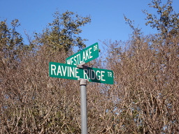
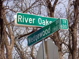
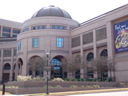
Route photos


Route quality
Waytypes & surfaces along the route
Waytypes
Road
18.2 km
(44 %)
Busy road
7.4 km
(18 %)
Surfaces
Paved
33.3 km
(81 %)
Unpaved
0.7 km
(2 %)
Asphalt
26.3 km
(64 %)
Concrete
6.4 km
(15 %)
Continue with Bikemap
Use, edit, or download this cycling route
You would like to ride Austin - Circle thru Lost Creek Blvd to Barton Creek and Costco or customize it for your own trip? Here is what you can do with this Bikemap route:
Free features
- Save this route as favorite or in collections
- Copy & plan your own version of this route
- Sync your route with Garmin or Wahoo
Premium features
Free trial for 3 days, or one-time payment. More about Bikemap Premium.
- Navigate this route on iOS & Android
- Export a GPX / KML file of this route
- Create your custom printout (try it for free)
- Download this route for offline navigation
Discover more Premium features.
Get Bikemap PremiumFrom our community
Other popular routes starting in Rollingwood
 Austin - Circle to McKinney Falls State Park
- Distance
- 40.3 km
- Ascent
- 360 m
- Descent
- 355 m
- Location
- Rollingwood, Texas, United States
 Austin - Circle Southeast to Richard Moya Park
- Distance
- 47.2 km
- Ascent
- 288 m
- Descent
- 288 m
- Location
- Rollingwood, Texas, United States
 Austin - Circle to MT Supermarket and Costco
- Distance
- 50.5 km
- Ascent
- 428 m
- Descent
- 428 m
- Location
- Rollingwood, Texas, United States
 Austin - Random Riding in Neighborhood North of MUNY Golf Course
- Distance
- 18.7 km
- Ascent
- 290 m
- Descent
- 290 m
- Location
- Rollingwood, Texas, United States
 Austin - Circle to Steiner Ranch
- Distance
- 56.1 km
- Ascent
- 757 m
- Descent
- 758 m
- Location
- Rollingwood, Texas, United States
 Austin - Circle to MT Supermarket and Walnut Creek
- Distance
- 49.2 km
- Ascent
- 414 m
- Descent
- 413 m
- Location
- Rollingwood, Texas, United States
 Austin - Circle to Northeast
- Distance
- 36.4 km
- Ascent
- 270 m
- Descent
- 276 m
- Location
- Rollingwood, Texas, United States
 Austin - Circle to Bee Cave
- Distance
- 44.6 km
- Ascent
- 562 m
- Descent
- 564 m
- Location
- Rollingwood, Texas, United States
Open it in the app