

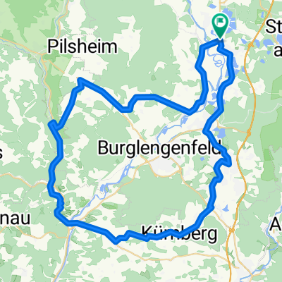
Einfürungstour / Sa 30.06.2012
A cycling route starting in Schwandorf in Bayern, Bavaria, Germany.
Overview
About this route
- -:--
- Duration
- 31.9 km
- Distance
- 230 m
- Ascent
- 230 m
- Descent
- ---
- Avg. speed
- ---
- Max. altitude

Route quality
Waytypes & surfaces along the route
Waytypes
Road
13.4 km
(42 %)
Quiet road
8.3 km
(26 %)
Surfaces
Paved
18.5 km
(58 %)
Unpaved
2.9 km
(9 %)
Asphalt
18.5 km
(58 %)
Gravel
1.9 km
(6 %)
Continue with Bikemap
Use, edit, or download this cycling route
You would like to ride Einfürungstour / Sa 30.06.2012 or customize it for your own trip? Here is what you can do with this Bikemap route:
Free features
- Save this route as favorite or in collections
- Copy & plan your own version of this route
- Sync your route with Garmin or Wahoo
Premium features
Free trial for 3 days, or one-time payment. More about Bikemap Premium.
- Navigate this route on iOS & Android
- Export a GPX / KML file of this route
- Create your custom printout (try it for free)
- Download this route for offline navigation
Discover more Premium features.
Get Bikemap PremiumFrom our community
Other popular routes starting in Schwandorf in Bayern
 Zur Alten Hochstraße
- Distance
- 19.4 km
- Ascent
- 207 m
- Descent
- 207 m
- Location
- Schwandorf in Bayern, Bavaria, Germany
 Einfürungstour / Sa 30.06.2012
- Distance
- 31.9 km
- Ascent
- 230 m
- Descent
- 230 m
- Location
- Schwandorf in Bayern, Bavaria, Germany
 Saale 4 kurz: Schwandorf - Kotzenbach, Gasthaus Mois, 70,5km, 271hm
- Distance
- 70.8 km
- Ascent
- 230 m
- Descent
- 183 m
- Location
- Schwandorf in Bayern, Bavaria, Germany
 Kallmünz übers Vilstal
- Distance
- 57.9 km
- Ascent
- 340 m
- Descent
- 343 m
- Location
- Schwandorf in Bayern, Bavaria, Germany
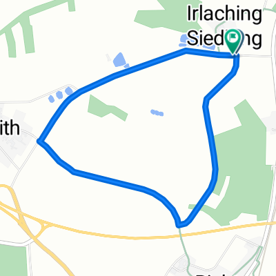
 Rund um Naabeck
- Distance
- 18.7 km
- Ascent
- 159 m
- Descent
- 159 m
- Location
- Schwandorf in Bayern, Bavaria, Germany
 Angerring 35, Schwandorf nach Angerring 34, Schwandorf
- Distance
- 17.4 km
- Ascent
- 199 m
- Descent
- 198 m
- Location
- Schwandorf in Bayern, Bavaria, Germany
 Richter Berg Ka1, 1,5km, 45HM
- Distance
- 3.8 km
- Ascent
- 58 m
- Descent
- 55 m
- Location
- Schwandorf in Bayern, Bavaria, Germany
 Drei-Schlösser-Runde
- Distance
- 55.7 km
- Ascent
- 398 m
- Descent
- 398 m
- Location
- Schwandorf in Bayern, Bavaria, Germany
Open it in the app