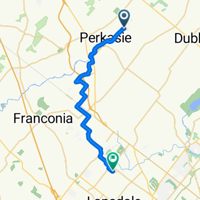
0
- 21.4 km
- 252 m
- 263 m
- Perkasie, Pennsylvania, United States
A cycling route starting in Perkasie, Pennsylvania, United States.
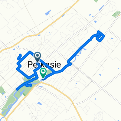
Overview
created this 1 year ago
Route quality
Quiet road
7 km
52 %
Road
5.5 km
41 %
Paved
3.2 km
(24 %)
Asphalt
3.2 km
24 %
Undefined
10.2 km
76 %
Continue with Bikemap
You would like to ride Chandler Way, Perkasie to 40 Foot Rd, Hatfield or customize it for your own trip? Here is what you can do with this Bikemap route:
Free trial for 3 days, or one-time payment. More about Bikemap Premium.
Discover more Premium features.
Get Bikemap PremiumFrom our community
Open it in the app