
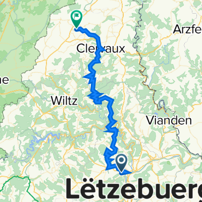
Chemin du Camping, Ettelbruck naar Sentier Pédestre National "Adrien Ries", Colmar-Berg
A cycling route starting in Warken, District de Diekirch, Luxembourg.
Overview
About this route
0
- 1:08 h
- Duration
- 8.9 km
- Distance
- 68 m
- Ascent
- 122 m
- Descent
- 7.9 km/h
- Avg. speed
- 266 m
- Max. altitude
bikemapuser931053076919483
created this 1 year ago
Route photos


Route quality
Waytypes & surfaces along the route
Waytypes
Quiet road
3.6 km
40 %
Path
1.4 km
16 %
Surfaces
Paved
8.4 km
(94 %)
Asphalt
7.9 km
89 %
Paved (undefined)
0.4 km
4 %
Continue with Bikemap
Use, edit, or download this cycling route
You would like to ride Chemin du Camping, Ettelbruck naar Sentier Pédestre National "Adrien Ries", Colmar-Berg or customize it for your own trip? Here is what you can do with this Bikemap route:
Free features
- Save this route as favorite or in collections
- Copy & plan your own version of this route
- Sync your route with Garmin or Wahoo
Premium features
Free trial for 3 days, or one-time payment. More about Bikemap Premium.
- Navigate this route on iOS & Android
- Export a GPX / KML file of this route
- Create your custom printout (try it for free)
- Download this route for offline navigation
Discover more Premium features.
Get Bikemap PremiumFrom our community
Other popular routes starting in Warken
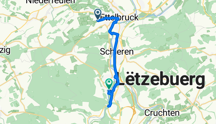
- Rue Tony Schmit 10, Ettelbruck to Station d'épuration, Mersch0
- 12.9 km
- 22 m
- 5 m
- Warken, District de Diekirch, Luxembourg
- Chemin du Camping, Ettelbruck naar Sentier Pédestre National "Adrien Ries", Colmar-Berg0
- 8.9 km
- 68 m
- 122 m
- Warken, District de Diekirch, Luxembourg


Open it in the app