

Route du plan d'eau to La Prise
A cycling route starting in Palinges, Bourgogne-Franche-Comté, France.
Overview
About this route
- 8 h 45 min
- Duration
- 99.9 km
- Distance
- 185 m
- Ascent
- 273 m
- Descent
- 11.4 km/h
- Avg. speed
- 340 m
- Max. altitude
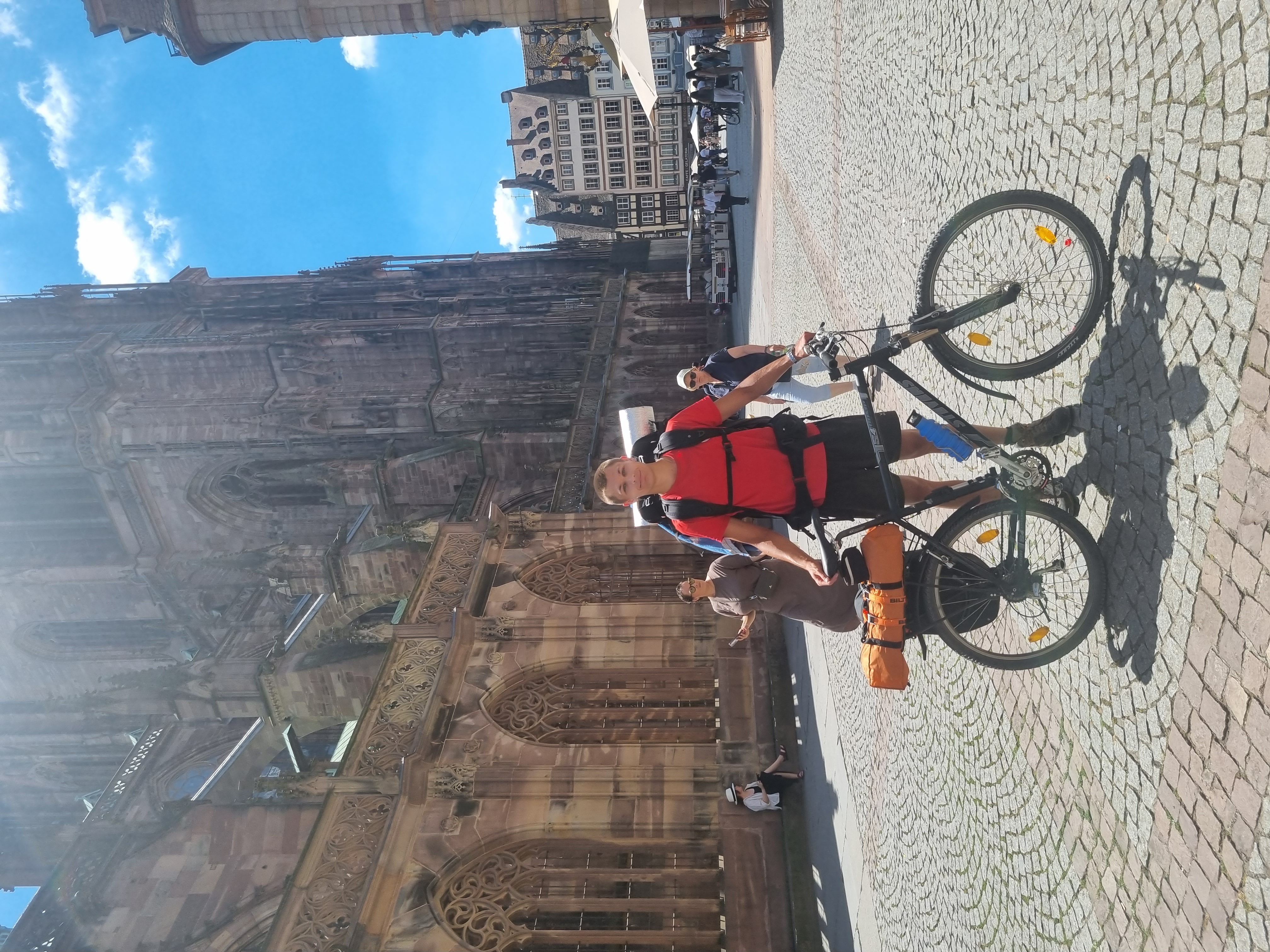
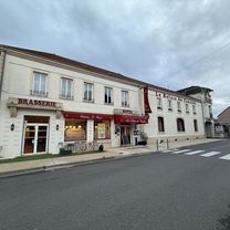
Route photos


Route quality
Waytypes & surfaces along the route
Waytypes
Quiet road
35.9 km
(36 %)
Path
35 km
(35 %)
Surfaces
Paved
48.9 km
(49 %)
Asphalt
44.9 km
(45 %)
Paved (undefined)
4 km
(4 %)
Undefined
50.9 km
(51 %)
Continue with Bikemap
Use, edit, or download this cycling route
You would like to ride Route du plan d'eau to La Prise or customize it for your own trip? Here is what you can do with this Bikemap route:
Free features
- Save this route as favorite or in collections
- Copy & plan your own version of this route
- Split it into stages to create a multi-day tour
- Sync your route with Garmin or Wahoo
Premium features
Free trial for 3 days, or one-time payment. More about Bikemap Premium.
- Navigate this route on iOS & Android
- Export a GPX / KML file of this route
- Create your custom printout (try it for free)
- Download this route for offline navigation
Discover more Premium features.
Get Bikemap PremiumFrom our community
Other popular routes starting in Palinges
 Route nach 9 Rue Auguste Mahaut, Nevers
- Distance
- 146.6 km
- Ascent
- 474 m
- Descent
- 567 m
- Location
- Palinges, Bourgogne-Franche-Comté, France
 EV6 - Day 13
- Distance
- 63.7 km
- Ascent
- 456 m
- Descent
- 468 m
- Location
- Palinges, Bourgogne-Franche-Comté, France
 palinges-camp du breuil bourbon lancy tandem 2017
- Distance
- 61.9 km
- Ascent
- 67 m
- Descent
- 90 m
- Location
- Palinges, Bourgogne-Franche-Comté, France
 Rue des 2 Églises, Saint-Vincent-Bragny nach Avenue du Général de Gaulle, Digoin
- Distance
- 14.3 km
- Ascent
- 102 m
- Descent
- 133 m
- Location
- Palinges, Bourgogne-Franche-Comté, France
 20200724 Day 8a - Palinges à Vitry-en-Charollais
- Distance
- 27.6 km
- Ascent
- 217 m
- Descent
- 246 m
- Location
- Palinges, Bourgogne-Franche-Comté, France
 Ziua a 5-a: Palinges - Chalon sur Saone
- Distance
- 98.6 km
- Ascent
- 421 m
- Descent
- 505 m
- Location
- Palinges, Bourgogne-Franche-Comté, France
 FR2-01_Palinges_Bourbon-Lancy_72,5km 290hm
- Distance
- 71.8 km
- Ascent
- 310 m
- Descent
- 298 m
- Location
- Palinges, Bourgogne-Franche-Comté, France
 Oudry_OU2a
- Distance
- 3.6 km
- Ascent
- 41 m
- Descent
- 43 m
- Location
- Palinges, Bourgogne-Franche-Comté, France
Open it in the app